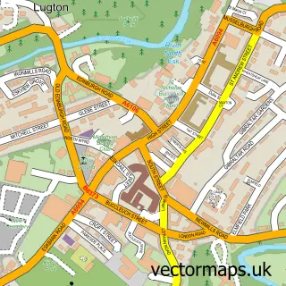
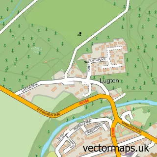
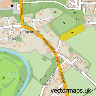
This Danderhall street map is a detailed vector street map covering a 750m x 750m area. Select a larger area to create and download your own vector street map of Danderhall.
The 750-metre map sample for Danderhall covers 430 mapped buildings and approximately 18.3 km of road detail, of which 30 named roads are named. The immediate area includes 8 GP surgeries within 2 miles, 1 pub and 7 MOT stations within 2 miles. The wider area around Danderhall features 2 food and drink venues. To create a larger or custom map of Danderhall, the map builder lets you define your own coverage area and download editable SVG, PDF and PNG files.
Create a larger editable map of Danderhall
Choose any area you need and generate a high-quality vector map instantly. Perfect for print, planning, design, business and personal use.

This Danderhall street map in Midlothian is available as downloadable SVG, PDF and PNG map files, or as a printed map for planning, business, display, education, local information and design work. You can also create a larger custom map area using the map selector.
What this Danderhall map sample shows
Danderhall lies within Midlothian parish, part of Dalkeith ward in the Midlothian local authority area. The postcode geography for this area includes the EH postcode area, the EH22 postcode district and the EH22 1 postcode sector. Residents fall under the Lothian for NHS services.
Local features near Danderhall
Within 2 milesAmenities and services in and around Danderhall.
Administrative and postcode information for Danderhall
The local authority covering Danderhall is Midlothian, within the county of Midlothian. The settlement lies within Dalkeith ward and Midlothian civil parish. The EH22 postcode district and EH22 1 postcode sector serve the immediate area. NHS provision in the area is delivered through Lothian.
Nearby street map samples around Danderhall

More street maps in Midlothian
750 metre map area coverage
Boundary, postcode and point of interest information for the 750m x 750m rectangle centred on this sample map.
Boundaries containing map centre
Constituency: Midlothian Co Const
District: Midlothian
Icb: Lothian
Postcode District: EH22
Postcode Sector: EH22 1
Ward: Dalkeith Ward
Nearby boundaries intersecting sample
Constituency: Edinburgh East and Musselburgh Burgh Const, Edinburgh South Burgh Const
District: City of Edinburgh
Postcode District: EH16
Postcode Sector: EH16 4
Ward: Liberton/Gilmerton Ward, Portobello/Craigmillar Ward
Postcode coverage
POI category counts
Beauty Salon: 3
Building Supply Store: 3
Bar: 2
Flowers And Gifts Shop: 2
Gym: 2
Janitorial Services: 2
Post Office: 2
Atms: 1
Automotive Repair: 1
Cafe: 1
Sample points of interest
- The Cooperative Food (BF) Danderhall (ERF), Danderhall
- Edmonstone Garage Ltd
- Danderhall Miners Club
- The Candy Bar
- Caramella MagicK
- Classique Bridal Hair & Make Up
- Classique Bridal Hair & Make Up
- AKD Systems
- Enlightened Trades
- Midlothian Roofing Maintenance
- Bonnie Bites
- GK valeting&detailing
Create a larger editable map of Danderhall
This sample shows only a 750 metre area. To create a larger map of Danderhall, use our map builder to choose your own coverage area, add titles and download editable SVG, PDF and PNG files.
Create a custom map of Danderhall