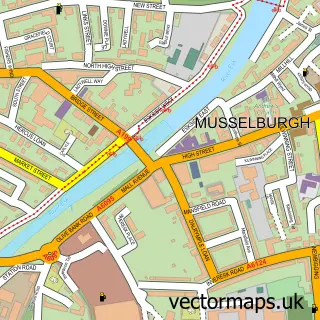
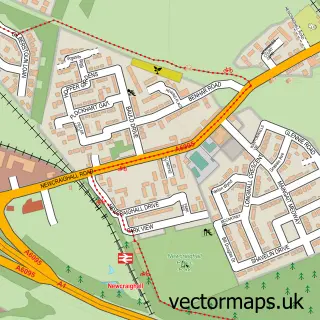
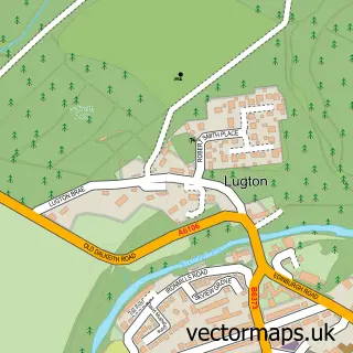
This Inveresk street map is a detailed vector street map covering a 750m x 750m area. Select a larger area to create and download your own vector street map of Inveresk.
The 750-metre map sample for Inveresk covers 177 mapped buildings and approximately 8.0 km of road detail, of which 17 named roads are named. The immediate area includes 2 GP surgeries within 2 miles and 8 MOT stations within 2 miles. The wider area around Inveresk features 4 tourism points of interest and 1 campsite within 2 miles. To create a larger or custom map of Inveresk, the map builder lets you define your own coverage area and download editable SVG, PDF and PNG files.
Create a larger editable map of Inveresk
Choose any area you need and generate a high-quality vector map instantly. Perfect for print, planning, design, business and personal use.

This Inveresk street map in East Lothian is available as downloadable SVG, PDF and PNG map files, or as a printed map for planning, business, display, education, local information and design work. You can also create a larger custom map area using the map selector.
What this Inveresk map sample shows
Inveresk lies within East Lothian parish, part of Musselburgh ward in the East Lothian local authority area. The postcode geography for this area includes the EH postcode area, the EH21 postcode district and the EH21 7 postcode sector. Residents fall under the Lothian for NHS services.
Local features near Inveresk
Within 2 milesAmenities and services in and around Inveresk.
Administrative and postcode information for Inveresk
The local authority covering Inveresk is East Lothian, within the county of East Lothian. The settlement lies within Musselburgh ward and East Lothian civil parish. The EH21 postcode district and EH21 7 postcode sector serve the immediate area. NHS provision in the area is delivered through Lothian.
Nearby street map samples around Inveresk

More street maps in East Lothian
750 metre map area coverage
Boundary, postcode and point of interest information for the 750m x 750m rectangle centred on this sample map.
Boundaries containing map centre
Constituency: Edinburgh East and Musselburgh Burgh Const
District: East Lothian
Icb: Lothian
Postcode District: EH21
Postcode Sector: EH21 7
Ward: Musselburgh Ward
Nearby boundaries intersecting sample
Constituency: Lothian East Co Const
Postcode Sector: EH21 6, EH21 8
Postcode coverage
POI category counts
Amateur Sports Team: 2
Landmark And Historical Building: 2
Attractions And Activities: 1
Builders: 1
Carpenter: 1
Carpet Cleaning: 1
Church Cathedral: 1
Cosmetic And Beauty Supplies: 1
Elementary School: 1
Legal Services: 1
Sample points of interest
- Acanthus Bridge Club Edinbugh
- Musselburgh Cricket Club
- Shepherd House Garden
- Woodrow Developments
- Michael W Hart
- Magic Carpet and Upholstery Cleaning
- St Michael's Parish Church
- The Skin & Lifestyle Edit
- Active Schools Musselburgh
- Inveresk Lodge Garden (National Trust for Scotland)
- Monktonhall
- Eskhill & Co
Create a larger editable map of Inveresk
This sample shows only a 750 metre area. To create a larger map of Inveresk, use our map builder to choose your own coverage area, add titles and download editable SVG, PDF and PNG files.
Create a custom map of Inveresk