Vector Maps logo
Home Why it works Popular maps Districts Samples Customizer Create Your Map
VectorMaps.uk
Home Popular maps Districts Samples Customizer Create Your Map Privacy Disclaimer
Home / UK Maps / Buckinghamshire / Penn Street Map

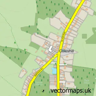
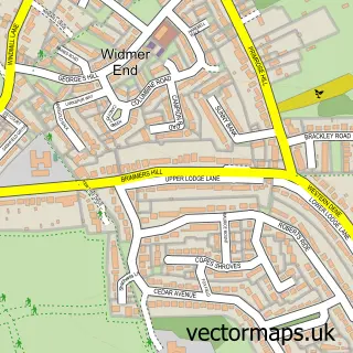
This Penn Street street map is a detailed vector street map covering a 750m x 750m area. Select a larger area to create and download your own vector street map of Penn Street.

Penn Street is a village in Buckinghamshire, in the South East of England. The settlement falls within the Chesham And Amersham parliamentary constituency. It is served by the HP7 postcode district, with HP7 0 as the local postcode sector.

The 750-metre map sample for Penn Street covers 55 mapped buildings and approximately 4.5 km of road detail. The immediate area includes 1 GP surgery within 2 miles, 2 pubs and 6 MOT stations within 2 miles. The wider area around Penn Street features 2 food and drink venues. To create a larger or custom map of Penn Street, the map builder lets you define your own coverage area and download editable SVG, PDF and PNG files.

55Buildings
4.46 kmRoads
0Named roads
7,168Residents within 2 miles
Create your own

Create a larger editable map of Penn Street

Choose any area you need and generate a high-quality vector map instantly. Perfect for print, planning, design, business and personal use.

Choose any location
Editable SVG files
Any size up to A0
PDF, PNG & more
Instant download
High quality guaranteed
Create My Custom Map
Secure, private & no credit card required
Penn Street Vector Street Map
750m Sample
Penn Street vector street map sample showing roads, buildings and local features in a 750 metre preview area
Buy Penn Street Map Print from £12.95 Buy Penn Street Digital Map from £6

This Penn Street street map in Buckinghamshire is available as downloadable SVG, PDF and PNG map files, or as a printed map for planning, business, display, education, local information and design work. You can also create a larger custom map area using the map selector.

What this Penn Street map sample shows

Penn Street lies within Penn Cp parish, part of Penn And Coleshill ward in the Buckinghamshire local authority area. The postcode geography for this area includes the HP postcode area, the HP7 postcode district and the HP7 0 postcode sector. Residents fall under the Nhs Buckinghamshire, Oxfordshire And Berkshire West Integrated Care Board for NHS services.

Local features near Penn Street

Within 2 miles

Amenities and services in and around Penn Street.

1 GP surgeries within 2 miles
6 MOT stations within 2 miles
2 Food & drink
2 Pubs
2 Vehicle services

Counts are approximate and based on publicly available data.

Administrative and postcode information for Penn Street

The local authority covering Penn Street is Buckinghamshire, within the county of Buckinghamshire. The settlement lies within Penn And Coleshill ward and Penn Cp civil parish. The HP7 postcode district and HP7 0 postcode sector serve the immediate area. NHS provision in the area is delivered through Buckinghamshire Healthcare Nhs Trust.

Parish Penn CP
Ward Penn and Coleshill
District / local authority Buckinghamshire
County Buckinghamshire
Historic county Buckinghamshire
Postcode district HP7
Postcode sector HP7 0
Parliamentary constituency Chesham and Amersham
Region South East
Country England

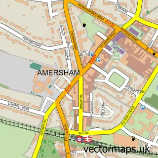
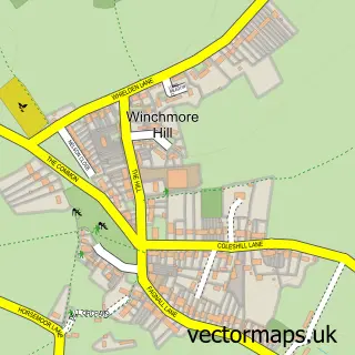
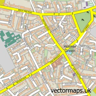
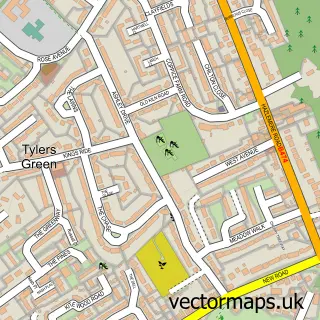
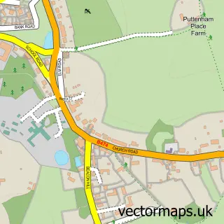
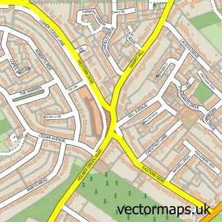
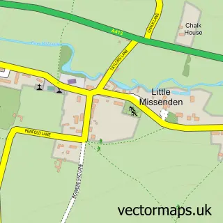
Nearby street map samples around Penn Street

Street map sample of Amersham, Buckinghamshire Amersham Town - Buckinghamshire - 3.0 miles Street map sample of St Albans, Hertfordshire St Albans City - Hertfordshire - 15.7 miles Street map sample of Winchmore Hill, Buckinghamshire Winchmore Hill Village - Buckinghamshire - 0.8 miles Street map sample of Holmer Green, Buckinghamshire Holmer Green Village - Buckinghamshire - 1.5 miles Street map sample of Tylers Green, Buckinghamshire Tylers Green Village - Buckinghamshire - 1.5 miles Street map sample of Coleshill, Buckinghamshire Coleshill Village - Buckinghamshire - 1.6 miles Street map sample of Penn, Buckinghamshire Penn Village - Buckinghamshire - 1.6 miles Street map sample of Hazlemere, Buckinghamshire Hazlemere Village - Buckinghamshire - 1.8 miles Street map sample of Little Missenden, Buckinghamshire Little Missenden Village - Buckinghamshire - 1.9 miles Street map sample of Widmer End, Buckinghamshire Widmer End Village - Buckinghamshire - 2.2 miles

More street maps in Buckinghamshire

Street map sample of Winchmore Hill, Buckinghamshire Winchmore Hill Village - 0.8 miles Street map sample of Holmer Green, Buckinghamshire Holmer Green Village - 1.5 miles Street map sample of Tylers Green, Buckinghamshire Tylers Green Village - 1.5 miles Street map sample of Coleshill, Buckinghamshire Coleshill Village - 1.6 miles Street map sample of Penn, Buckinghamshire Penn Village - 1.6 miles

750 metre map area coverage

Boundary, postcode and point of interest information for the 750m x 750m rectangle centred on this sample map.

Boundaries containing map centre

Constituency: Chesham and Amersham Co Const

District: Buckinghamshire

Icb: NHS Thames Valley ICB

Parish: Penn CP

Police Force: thames valley

Postcode District: HP7

Postcode Sector: HP7 0

Ward: Penn, Tylers Green & Loudwater Ward

Nearby boundaries intersecting sample

Postcode District: HP10

Postcode Sector: HP10 8

Postcode coverage

HP7 HP7 0 HP10 HP10 8

POI category counts

Advertising Agency: 2

Automotive Repair: 2

Business Management Services: 2

Business Manufacturing And Supply: 2

Distillery: 2

Printing Services: 2

Pub: 2

Retail: 2

Art Gallery: 1

Art School: 1

Sample points of interest

  • BDI Creative Advertising Agency
  • Blabbermouth Marketing Advertising Agency
  • Penn Street Gallery Art Gallery
  • Jo Jingles Art School
  • Bespoke Framing Arts And Crafts
  • Classic & Custom Works Automotive Repair
  • Market Autos Limited Automotive Repair
  • Light Solutions Building Supply Store
  • Choice Business Loans Business Financing
  • Thunderbird Scenery Ltd. Business Management Services
  • Urban Media Business Management Services
  • Boxrent Limited Business Manufacturing And Supply

Create a larger editable map of Penn Street

This sample shows only a 750 metre area. To create a larger map of Penn Street, use our map builder to choose your own coverage area, add titles and download editable SVG, PDF and PNG files.

Create a custom map of Penn Street

Phone 01751 473136 | Copyright Vectormaps.uk 2026

Samples Customizer Privacy Disclaimer
Penn Street Vector Street Map
Penn Street enlarged street map sample showing a 750 metre preview area