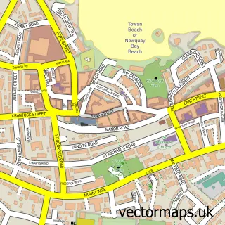
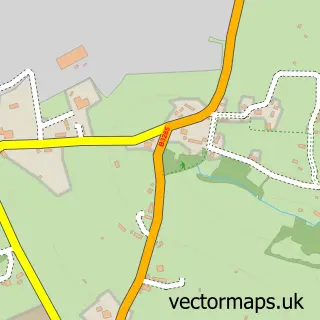
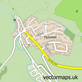
This Perranporth street map is a detailed vector street map covering a 750m x 750m area. Select a larger area to create and download your own vector street map of Perranporth.
The 750-metre map sample for Perranporth covers 530 mapped buildings and approximately 18.1 km of road detail, of which 42 named roads are named. The immediate area includes 1 GP surgery and 5 pubs. The wider area around Perranporth features 11 tourism points of interest, 23 food and drink venues and 13 hotels. To create a larger or custom map of Perranporth, the map builder lets you define your own coverage area and download editable SVG, PDF and PNG files.
Create a larger editable map of Perranporth
Choose any area you need and generate a high-quality vector map instantly. Perfect for print, planning, design, business and personal use.

This Perranporth street map in Cornwall is available as downloadable SVG, PDF and PNG map files, or as a printed map for planning, business, display, education, local information and design work. You can also create a larger custom map area using the map selector.
What this Perranporth map sample shows
Perranporth lies within Perranzabuloe Cp parish, part of Perranporth ward in the Cornwall local authority area. The postcode geography for this area includes the TR postcode area, the TR6 postcode district and the TR6 0 postcode sector. Residents fall under the Nhs Cornwall And The Isles Of Scilly Integrated Care Board for NHS services.
Local features near Perranporth
Within 2 milesAmenities and services in and around Perranporth.
Administrative and postcode information for Perranporth
The local authority covering Perranporth is Cornwall, within the county of Cornwall. The settlement lies within Perranporth ward and Perranzabuloe Cp civil parish. The TR6 postcode district and TR6 0 postcode sector serve the immediate area. NHS provision in the area is delivered through Royal Cornwall Hospitals Nhs Trust.
Nearby street map samples around Perranporth

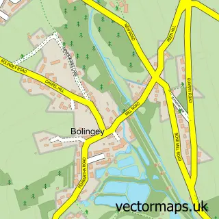
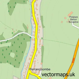
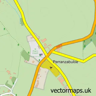
More street maps in Cornwall
750 metre map area coverage
Boundary, postcode and point of interest information for the 750m x 750m rectangle centred on this sample map.
Boundaries containing map centre
Constituency: Camborne and Redruth Co Const
District: Cornwall
Icb: NHS Cornwall and the Isles of Scilly ICB
Parish: Perranzabuloe CP
Police Force: devon and cornwall
Postcode District: TR6
Postcode Sector: TR6 0
Nearby boundaries intersecting sample
No additional intersecting boundaries found.
Postcode coverage
POI category counts
Hotel: 14
Holiday Rental Home: 12
Flowers And Gifts Shop: 10
Cafe: 7
Clothing Store: 6
Coffee Shop: 6
Convenience Store: 5
Ice Cream Shop: 5
Pub: 5
Real Estate Agent: 5
Sample points of interest
- Design Unltd
- Perranporth: St Michael Mission Church
- Beyond The Sea Gallery
- Colour & Space
- Driftwood Carpentry
- Perran Hardware
- PayPoint
- Perranporth Gardens Charities
- Sps Electrics
- Clean my Ride Mobile Valeting
- Riley Garage
- Riley Garage
Create a larger editable map of Perranporth
This sample shows only a 750 metre area. To create a larger map of Perranporth, use our map builder to choose your own coverage area, add titles and download editable SVG, PDF and PNG files.
Create a custom map of Perranporth