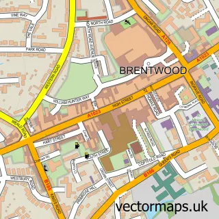
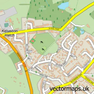
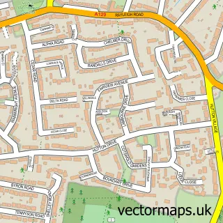
This Pilgrims' Hatch street map is a detailed vector street map covering a 750m x 750m area. Select a larger area to create and download your own vector street map of Pilgrims' Hatch.
The 750-metre map sample for Pilgrims' Hatch covers 377 mapped buildings and approximately 10.2 km of road detail, of which 17 named roads are named. The immediate area includes 4 GP surgeries within 2 miles and 8 MOT stations within 2 miles. The wider area around Pilgrims' Hatch features 1 hotel and 1 campsite within 2 miles. To create a larger or custom map of Pilgrims' Hatch, the map builder lets you define your own coverage area and download editable SVG, PDF and PNG files.
Create a larger editable map of Pilgrims' Hatch
Choose any area you need and generate a high-quality vector map instantly. Perfect for print, planning, design, business and personal use.

This Pilgrims' Hatch street map in Essex is available as downloadable SVG, PDF and PNG map files, or as a printed map for planning, business, display, education, local information and design work. You can also create a larger custom map area using the map selector.
What this Pilgrims' Hatch map sample shows
Pilgrims' Hatch lies within Essex County parish, part of Pilgrims Hatch ward in the Brentwood District (B) local authority area. The postcode geography for this area includes the CM postcode area, the CM15 postcode district and the CM15 9 postcode sector. Residents fall under the Nhs Mid And South Essex Integrated Care Board for NHS services.
Local features near Pilgrims' Hatch
Within 2 milesAmenities and services in and around Pilgrims' Hatch.
Administrative and postcode information for Pilgrims' Hatch
Pilgrims' Hatch lies within Essex County parish, part of Pilgrims Hatch ward in the Brentwood District (B) local authority area. The postcode geography for this area includes the CM postcode area, the CM15 postcode district and the CM15 9 postcode sector. Residents fall under the Nhs Mid And South Essex Integrated Care Board for NHS services.
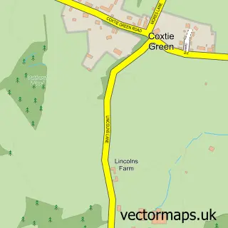
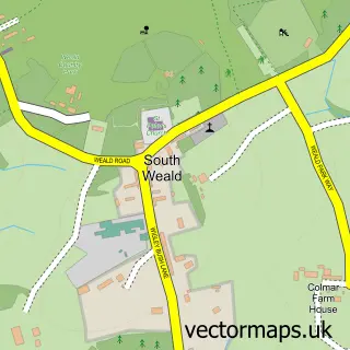
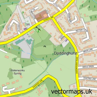
Nearby street map samples around Pilgrims' Hatch

More street maps in Essex
750 metre map area coverage
Boundary, postcode and point of interest information for the 750m x 750m rectangle centred on this sample map.
Boundaries containing map centre
Constituency: Brentwood and Ongar Co Const
County: Essex County
District: Brentwood District (B)
Icb: NHS Essex ICB
Police Force: essex
Postcode District: CM15
Postcode Sector: CM15 9
Ward: Pilgrims Hatch Ward
Nearby boundaries intersecting sample
No additional intersecting boundaries found.
Postcode coverage
POI category counts
Building Supply Store: 4
Cleaning Services: 3
Electrician: 2
Pet Groomer: 2
Arts And Entertainment: 1
Awning Supplier: 1
Butcher Shop: 1
Ceiling Service: 1
Charity Organization: 1
Convenience Store: 1
Sample points of interest
- Richard Keil Photography
- Regal Awnings
- Arrow Fencing
- Barbara Crichton Curtains
- Brentwood Roofing
- John Copp Pebbledashing
- Bert's Butchers
- The Rubber Roofing Centre
- Escape Animal Sanctuary And Conservation Centre
- Safeclean
- Saferclean - Matt Pepper
- Take a Break Domestic Clean & Iron
Create a larger editable map of Pilgrims' Hatch
This sample shows only a 750 metre area. To create a larger map of Pilgrims' Hatch, use our map builder to choose your own coverage area, add titles and download editable SVG, PDF and PNG files.
Create a custom map of Pilgrims' Hatch