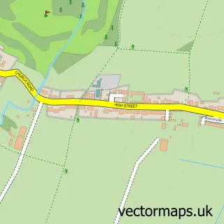
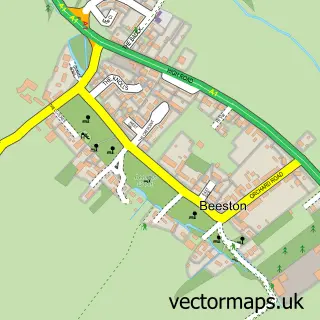
This Potton street map is a detailed vector street map covering a 750m x 750m area. Select a larger area to create and download your own vector street map of Potton.
The 750-metre map sample for Potton covers 605 mapped buildings and approximately 15.8 km of road detail, of which 36 named roads are named. The immediate area includes 1 GP surgery, 3 pubs and 1 MOT station, with 3 within 2 miles. The wider area around Potton features 3 tourism points of interest and 6 food and drink venues. To create a larger or custom map of Potton, the map builder lets you define your own coverage area and download editable SVG, PDF and PNG files.
Create a larger editable map of Potton
Choose any area you need and generate a high-quality vector map instantly. Perfect for print, planning, design, business and personal use.

This Potton street map in Bedfordshire is available as downloadable SVG, PDF and PNG map files, or as a printed map for planning, business, display, education, local information and design work. You can also create a larger custom map area using the map selector.
What this Potton map sample shows
Potton lies within Potton Cp parish, part of Potton ward in the Central Bedfordshire local authority area. The postcode geography for this area includes the SG postcode area, the SG19 postcode district and the SG19 2 postcode sector. Residents fall under the Nhs Bedfordshire, Luton And Milton Keynes Integrated Care Board for NHS services.
Local features near Potton
Within 2 milesAmenities and services in and around Potton.
Administrative and postcode information for Potton
Potton lies within Potton Cp parish, part of Potton ward in the Central Bedfordshire local authority area. The postcode geography for this area includes the SG postcode area, the SG19 postcode district and the SG19 2 postcode sector. Residents fall under the Nhs Bedfordshire, Luton And Milton Keynes Integrated Care Board for NHS services.
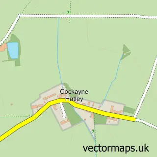
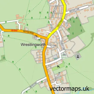
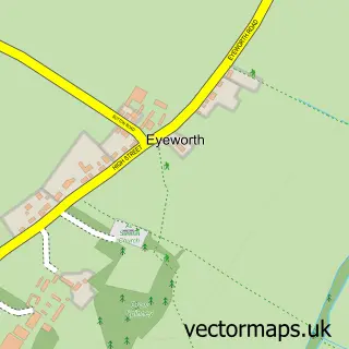
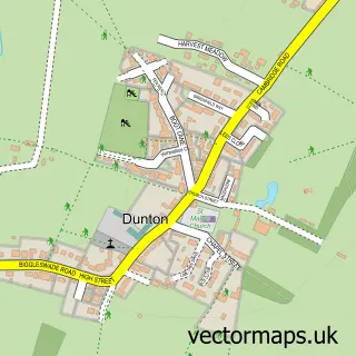
Nearby street map samples around Potton

More street maps in Bedfordshire
750 metre map area coverage
Boundary, postcode and point of interest information for the 750m x 750m rectangle centred on this sample map.
Boundaries containing map centre
Constituency: North Bedfordshire Co Const
District: Central Bedfordshire
Icb: NHS Central East ICB
Parish: Potton CP
Police Force: bedfordshire
Postcode District: SG19
Postcode Sector: SG19 2
Ward: Potton Ward
Nearby boundaries intersecting sample
No additional intersecting boundaries found.
Postcode coverage
POI category counts
Beauty Salon: 7
Beauty And Spa: 4
Gas Station: 3
Pub: 3
Accountant: 2
Bakery: 2
Barber: 2
Carpet Store: 2
Coffee Shop: 2
Community Services Non Profits: 2
Sample points of interest
- Amy Taylor Accountancy
- R J Whitmore & Company
- Paul Pibworth - Artist, Sculptor, Journeyman
- Mundy Media
- Henry Smith Playing Field
- Shannon Motors
- Hashtag Mechanic Ltd
- Lindsays Bakery
- Lucy Jane's Bakery
- Potton Baptist Church
- The Dog and Pigeon
- Casanova Barber
Create a larger editable map of Potton
This sample shows only a 750 metre area. To create a larger map of Potton, use our map builder to choose your own coverage area, add titles and download editable SVG, PDF and PNG files.
Create a custom map of Potton