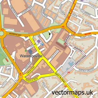
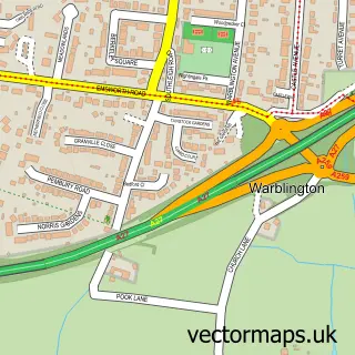
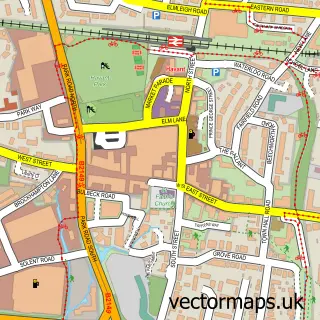
This Purbrook street map is a detailed vector street map covering a 750m x 750m area. Select a larger area to create and download your own vector street map of Purbrook.
The 750-metre map sample for Purbrook covers 403 mapped buildings and approximately 15.5 km of road detail, of which 37 named roads are named. The immediate area includes 3 GP surgeries within 2 miles, 1 pub and 15 MOT stations within 2 miles. The wider area around Purbrook features 2 tourism points of interest and 2 food and drink venues. To create a larger or custom map of Purbrook, the map builder lets you define your own coverage area and download editable SVG, PDF and PNG files.
Create a larger editable map of Purbrook
Choose any area you need and generate a high-quality vector map instantly. Perfect for print, planning, design, business and personal use.

This Purbrook street map in Hampshire is available as downloadable SVG, PDF and PNG map files, or as a printed map for planning, business, display, education, local information and design work. You can also create a larger custom map area using the map selector.
What this Purbrook map sample shows
Purbrook lies within Hampshire County parish, part of Purbrook ward in the Havant District (B) local authority area. The postcode geography for this area includes the PO postcode area, the PO7 postcode district and the PO7 5 postcode sector. Residents fall under the Nhs Hampshire And Isle Of Wight Integrated Care Board for NHS services.
Local features near Purbrook
Within 2 milesAmenities and services in and around Purbrook.
Administrative and postcode information for Purbrook
The local authority covering Purbrook is Havant District (B), within the county of Hampshire. The settlement lies within Purbrook ward and Hampshire County civil parish. The PO7 postcode district and PO7 5 postcode sector serve the immediate area. NHS provision in the area is delivered through Portsmouth Hospitals University National Health Service Trust.
Nearby street map samples around Purbrook


More street maps in Hampshire
750 metre map area coverage
Boundary, postcode and point of interest information for the 750m x 750m rectangle centred on this sample map.
Boundaries containing map centre
Constituency: Havant Boro Const
County: Hampshire County
District: Havant District (B)
Icb: NHS Hampshire and Isle of Wight ICB
Police Force: hampshire
Postcode District: PO7
Postcode Sector: PO7 5
Ward: Purbrook Ward
Nearby boundaries intersecting sample
Constituency: Fareham and Waterlooville Co Const
District: Winchester District (B)
Parish: Newlands CP, Southwick and Widley CP
Ward: Southwick & Wickham Ward, Stakes Ward
Postcode coverage
POI category counts
Beauty Salon: 5
Car Dealer: 4
Church Cathedral: 3
Hair Salon: 3
It Service And Computer Repair: 3
Tree Services: 3
Accountant: 2
Barber: 2
Beauty And Spa: 2
Community Center: 2
Sample points of interest
- Sally Grant Ltd.
- TaxAssist Accountants
- Purbrook: St John the Baptist
- The Southern Co-Operative Purbrook London Road (ERF), Purbrook
- The Village bakery and cafe
- The Box
- Uppercutz barbers
- Jacqueline's Hair Salon
- The artful hairstylist Liz Cooper
- 3d Hair & Beauty
- Gino's
- Nail Couture by Danielle Scott
Create a larger editable map of Purbrook
This sample shows only a 750 metre area. To create a larger map of Purbrook, use our map builder to choose your own coverage area, add titles and download editable SVG, PDF and PNG files.
Create a custom map of Purbrook