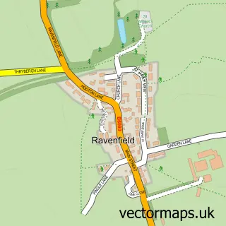
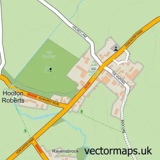
This Ravenfield street map is a detailed vector street map covering a 750m x 750m area. Select a larger area to create and download your own vector street map of Ravenfield.
The 750-metre map sample for Ravenfield covers 528 mapped buildings and approximately 18.2 km of road detail, of which 31 named roads are named. The immediate area includes 2 GP surgeries within 2 miles, 1 pub and 1 MOT station, with 7 within 2 miles. The wider area around Ravenfield features 1 tourism point of interest, 1 food and drink venue and 1 campsite within 2 miles. To create a larger or custom map of Ravenfield, the map builder lets you define your own coverage area and download editable SVG, PDF and PNG files.
Create a larger editable map of Ravenfield
Choose any area you need and generate a high-quality vector map instantly. Perfect for print, planning, design, business and personal use.

This Ravenfield street map in South Yorkshire is available as downloadable SVG, PDF and PNG map files, or as a printed map for planning, business, display, education, local information and design work. You can also create a larger custom map area using the map selector.
What this Ravenfield map sample shows
Ravenfield lies within Bramley Cp parish, part of Wickersley ward in the Rotherham District (B) local authority area. The postcode geography for this area includes the S postcode area, the S66 postcode district and the S66 2 postcode sector. Residents fall under the Nhs South Yorkshire Integrated Care Board for NHS services.
Local features near Ravenfield
Within 2 milesAmenities and services in and around Ravenfield.
Administrative and postcode information for Ravenfield
The local authority covering Ravenfield is Rotherham District (B), within the county of South Yorkshire. The settlement lies within Wickersley ward and Bramley Cp civil parish. The S66 postcode district and S66 2 postcode sector serve the immediate area. NHS provision in the area is delivered through The Rotherham Nhs Foundation Trust.
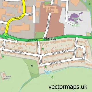
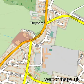
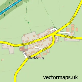
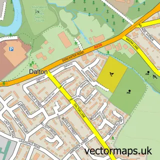
Nearby street map samples around Ravenfield

More street maps in South Yorkshire
750 metre map area coverage
Boundary, postcode and point of interest information for the 750m x 750m rectangle centred on this sample map.
Boundaries containing map centre
Constituency: Rawmarsh and Conisbrough Co Const
District: Rotherham District (B)
Icb: NHS South Yorkshire ICB
Parish: Ravenfield CP
Police Force: south yorkshire
Postcode District: S65
Postcode Sector: S65 4
Ward: Bramley & Ravenfield Ward
Nearby boundaries intersecting sample
Constituency: Rotherham Boro Const
Parish: Bramley CP, Dalton CP
Postcode District: S66
Postcode Sector: S66 3
Ward: Wickersley North Ward
Postcode coverage
POI category counts
Automotive Repair: 2
Land Surveying: 2
Beauty Salon: 1
Car Dealer: 1
Chiropractor: 1
Contractor: 1
Convenience Store: 1
Courier And Delivery Services: 1
Doctor: 1
Drugstore: 1
Sample points of interest
- Hollings Auto Services
- Pecar Motors Ltd
- Escape To Beauty Rotherham
- Autoline Car sales Rotherham
- Hollings Lane Clinic
- Williams Floor Restoration
- Ravenfield Stores
- Evri ParcelShop
- Ravenfield Medical Centre
- Ravenfield Pharmacy
- Ravenfield Hearing Impaired Department
- Ravenfield Primary
Create a larger editable map of Ravenfield
This sample shows only a 750 metre area. To create a larger map of Ravenfield, use our map builder to choose your own coverage area, add titles and download editable SVG, PDF and PNG files.
Create a custom map of Ravenfield