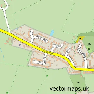
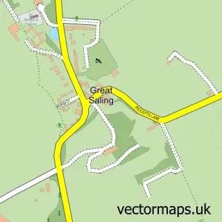
This Rayne street map is a detailed vector street map covering a 750m x 750m area. Select a larger area to create and download your own vector street map of Rayne.
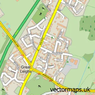
The 750-metre map sample for Rayne covers 381 mapped buildings and approximately 10.4 km of road detail, of which 25 named roads are named. The immediate area includes 1 school, 1 GP surgery within 2 miles, 1 pub and 9 MOT stations within 2 miles. The wider area around Rayne features 1 tourism point of interest and 4 food and drink venues. To create a larger or custom map of Rayne, the map builder lets you define your own coverage area and download editable SVG, PDF and PNG files.
Create a larger editable map of Rayne
Choose any area you need and generate a high-quality vector map instantly. Perfect for print, planning, design, business and personal use.

This Rayne street map in Essex is available as downloadable SVG, PDF and PNG map files, or as a printed map for planning, business, display, education, local information and design work. You can also create a larger custom map area using the map selector.
What this Rayne map sample shows
Rayne lies within Rayne Cp parish, part of Rayne ward in the Braintree District local authority area. The postcode geography for this area includes the CM postcode area, the CM77 postcode district and the CM77 6 postcode sector. Residents fall under the Nhs Mid And South Essex Integrated Care Board for NHS services.
Local features near Rayne
Within 2 milesAmenities and services in and around Rayne.
Administrative and postcode information for Rayne
The local authority covering Rayne is Braintree District, within the county of Essex. The settlement lies within Rayne ward and Rayne Cp civil parish. The CM77 postcode district and CM77 6 postcode sector serve the immediate area. NHS provision in the area is delivered through Mid And South Essex Nhs Foundation Trust.
Nearby street map samples around Rayne

More street maps in Essex
750 metre map area coverage
Boundary, postcode and point of interest information for the 750m x 750m rectangle centred on this sample map.
Boundaries containing map centre
Constituency: Braintree Co Const
County: Essex County
District: Braintree District
Icb: NHS Essex ICB
Parish: Rayne CP
Police Force: essex
Postcode District: CM77
Postcode Sector: CM77 6
Ward: Rayne Ward
Nearby boundaries intersecting sample
No additional intersecting boundaries found.
Postcode coverage
POI category counts
Beauty Salon: 2
British Restaurant: 2
Cafe: 2
Key And Locksmith: 2
Party Supply: 2
Scout Hall: 2
Shipping Center: 2
Architectural Designer: 1
Beauty And Spa: 1
Building Supply Store: 1
Sample points of interest
- Edward Parsley Associates
- The Glamour Room
- Essex Beauty & Aesthetics Academy
- The Olive Tree Beauty Barn
- 47 the Street
- Fortyseven TheStreet
- Brinkley Roofing Ltd
- Booking Hall Cafe
- The Booking Hall Cafe
- Eagle Training
- 1st Rayne Scout Group HQ
- Gatehouse Construction
Create a larger editable map of Rayne
This sample shows only a 750 metre area. To create a larger map of Rayne, use our map builder to choose your own coverage area, add titles and download editable SVG, PDF and PNG files.
Create a custom map of Rayne