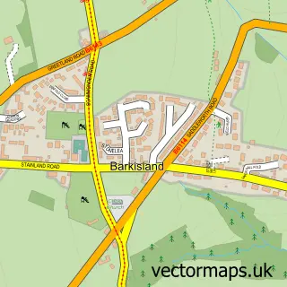
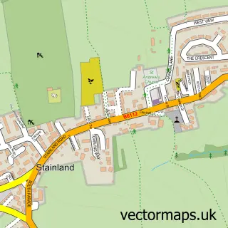
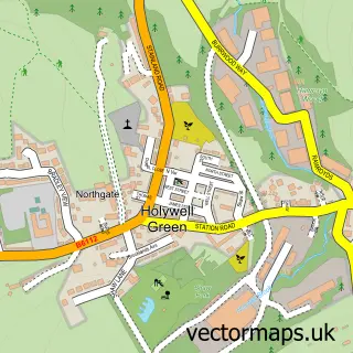
This Ripponden street map is a detailed vector street map covering a 750m x 750m area. Select a larger area to create and download your own vector street map of Ripponden.
The 750-metre map sample for Ripponden covers 220 mapped buildings and approximately 16.1 km of road detail, of which 27 named roads are named. The immediate area includes 1 school, 1 GP surgery and 3 pubs. The wider area around Ripponden features 1 tourism point of interest and 11 food and drink venues. To create a larger or custom map of Ripponden, the map builder lets you define your own coverage area and download editable SVG, PDF and PNG files.
Create a larger editable map of Ripponden
Choose any area you need and generate a high-quality vector map instantly. Perfect for print, planning, design, business and personal use.

This Ripponden street map in West Yorkshire is available as downloadable SVG, PDF and PNG map files, or as a printed map for planning, business, display, education, local information and design work. You can also create a larger custom map area using the map selector.
What this Ripponden map sample shows
Ripponden lies within Ripponden Cp parish, part of Ryburn ward in the Calderdale District (B) local authority area. The postcode geography for this area includes the HX postcode area, the HX6 postcode district and the HX6 4 postcode sector. Residents fall under the Nhs West Yorkshire Integrated Care Board for NHS services.
Local features near Ripponden
Within 2 milesAmenities and services in and around Ripponden.
Administrative and postcode information for Ripponden
The local authority covering Ripponden is Calderdale District (B), within the county of West Yorkshire. The settlement lies within Ryburn ward and Ripponden Cp civil parish. The HX6 postcode district and HX6 4 postcode sector serve the immediate area. NHS provision in the area is delivered through Calderdale And Huddersfield Nhs Foundation Trust.
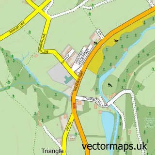
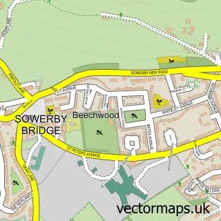
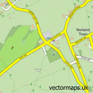
Nearby street map samples around Ripponden

More street maps in West Yorkshire
750 metre map area coverage
Boundary, postcode and point of interest information for the 750m x 750m rectangle centred on this sample map.
Boundaries containing map centre
Constituency: Calder Valley Co Const
District: Calderdale District (B)
Icb: NHS West Yorkshire ICB
Parish: Ripponden CP
Police Force: west yorkshire
Postcode District: HX6
Postcode Sector: HX6 4
Ward: Ryburn Ward
Nearby boundaries intersecting sample
No additional intersecting boundaries found.
Postcode coverage
POI category counts
Beauty Salon: 6
Coffee Shop: 5
Real Estate Agent: 5
Building Supply Store: 4
Hair Salon: 4
Beauty And Spa: 3
Pub: 3
Bar: 2
Church Cathedral: 2
Community Center: 2
Sample points of interest
- Crowthers Ltd.
- Premier Taekwondo Halifax
- Wordology
- Clapham Agricultural Engineering
- St Bartholomew
- Deltaleigh
- The Cooperative Food (BF) Oldham Road - Ripponden, Ripponden
- Halifax Hifi Centre
- J Motors - Ripponden
- A Jar of Cake
- Golden Lion Hotel
- The Golden Lion
Create a larger editable map of Ripponden
This sample shows only a 750 metre area. To create a larger map of Ripponden, use our map builder to choose your own coverage area, add titles and download editable SVG, PDF and PNG files.
Create a custom map of Ripponden