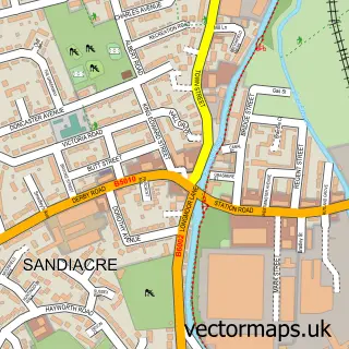
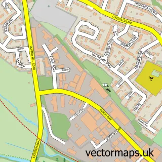
This Risley street map is a detailed vector street map covering a 750m x 750m area. Select a larger area to create and download your own vector street map of Risley.
The 750-metre map sample for Risley covers 92 mapped buildings and approximately 13.5 km of road detail, of which 3 named roads are named. The immediate area includes 1 school, 2 GP surgeries within 2 miles, 2 pubs and 12 MOT stations within 2 miles. The wider area around Risley features 1 tourism point of interest, 2 food and drink venues and 2 hotels. To create a larger or custom map of Risley, the map builder lets you define your own coverage area and download editable SVG, PDF and PNG files.
Create a larger editable map of Risley
Choose any area you need and generate a high-quality vector map instantly. Perfect for print, planning, design, business and personal use.

This Risley street map in Derbyshire is available as downloadable SVG, PDF and PNG map files, or as a printed map for planning, business, display, education, local information and design work. You can also create a larger custom map area using the map selector.
What this Risley map sample shows
Risley lies within Risley Cp parish, part of Draycott & Risley ward in the Erewash District (B) local authority area. The postcode geography for this area includes the DE postcode area, the DE72 postcode district and the DE72 3 postcode sector. Residents fall under the Nhs Derby And Derbyshire Integrated Care Board for NHS services.
Local features near Risley
Within 2 milesAmenities and services in and around Risley.
Administrative and postcode information for Risley
The local authority covering Risley is Erewash District (B), within the county of Derbyshire. The settlement lies within Draycott & Risley ward and Risley Cp civil parish. The DE72 postcode district and DE72 3 postcode sector serve the immediate area. NHS provision in the area is delivered through Nottingham University Hospitals Nhs Trust.
Nearby street map samples around Risley

More street maps in Derbyshire
750 metre map area coverage
Boundary, postcode and point of interest information for the 750m x 750m rectangle centred on this sample map.
Boundaries containing map centre
Constituency: Erewash Co Const
County: Derbyshire County
District: Erewash District (B)
Icb: NHS Derby and Derbyshire ICB
Parish: Risley CP
Police Force: derbyshire
Postcode District: DE72
Postcode Sector: DE72 3
Ward: Draycott & Risley Ward
Nearby boundaries intersecting sample
Parish: Breaston CP
Postcode District: NG10
Postcode Sector: NG10 5
Ward: Breaston Ward
Postcode coverage
POI category counts
Hotel: 2
Pub: 2
Active Life: 1
Arts And Entertainment: 1
Assisted Living Facility: 1
Bed And Breakfast: 1
Car Dealer: 1
Charity Organization: 1
Church Cathedral: 1
Community Services Non Profits: 1
Sample points of interest
- Risley Cricket Club
- Bob Morley
- Woodhall Park Nursing Home
- Risley Guest House
- Risley Car Centre
- Treetops Funding
- All Saints' Church
- Rotary Club of Long Eaton - RCLE
- Dynamicmotif Dance & Performing Arts Academy
- Chatsworth Financial Consultancy
- Marlowe Fire & Security
- Fresh Garden Produce
Create a larger editable map of Risley
This sample shows only a 750 metre area. To create a larger map of Risley, use our map builder to choose your own coverage area, add titles and download editable SVG, PDF and PNG files.
Create a custom map of Risley