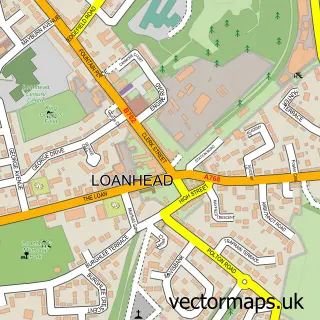
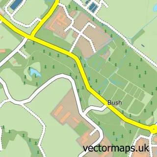
This Roslin street map is a detailed vector street map covering a 750m x 750m area. Select a larger area to create and download your own vector street map of Roslin.
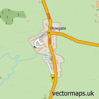
The 750-metre map sample for Roslin covers 310 mapped buildings and approximately 11.9 km of road detail, of which 20 named roads are named. The immediate area includes 2 GP surgeries within 2 miles, 2 pubs and 9 MOT stations within 2 miles. The wider area around Roslin features 6 tourism points of interest, 3 food and drink venues and 2 hotels. To create a larger or custom map of Roslin, the map builder lets you define your own coverage area and download editable SVG, PDF and PNG files.
Create a larger editable map of Roslin
Choose any area you need and generate a high-quality vector map instantly. Perfect for print, planning, design, business and personal use.

This Roslin street map in Midlothian is available as downloadable SVG, PDF and PNG map files, or as a printed map for planning, business, display, education, local information and design work. You can also create a larger custom map area using the map selector.
What this Roslin map sample shows
Roslin lies within Midlothian parish, part of Midlothian West ward in the Midlothian local authority area. The postcode geography for this area includes the EH postcode area, the EH25 postcode district and the EH25 9 postcode sector. Residents fall under the Lothian for NHS services.
Local features near Roslin
Within 2 milesAmenities and services in and around Roslin.
Administrative and postcode information for Roslin
Roslin lies within Midlothian parish, part of Midlothian West ward in the Midlothian local authority area. The postcode geography for this area includes the EH postcode area, the EH25 postcode district and the EH25 9 postcode sector. Residents fall under the Lothian for NHS services.
Nearby street map samples around Roslin

More street maps in Midlothian
750 metre map area coverage
Boundary, postcode and point of interest information for the 750m x 750m rectangle centred on this sample map.
Boundaries containing map centre
Constituency: Midlothian Co Const
District: Midlothian
Icb: Lothian
Postcode District: EH25
Postcode Sector: EH25 9
Ward: Midlothian West Ward
Nearby boundaries intersecting sample
No additional intersecting boundaries found.
Postcode coverage
POI category counts
Landmark And Historical Building: 3
Library: 3
Community Services Non Profits: 2
Convenience Store: 2
Dentist: 2
Home Developer: 2
Hotel: 2
Park: 2
Pharmaceutical Products Wholesaler: 2
Post Office: 2
Sample points of interest
- Roslin Chapel Guesthouse
- Payzone
- Noble Beauty Salon
- Skip Hire Midlothian
- Slatebarns CL
- Roslin Church
- Costa Express
- Oak Ash & Thorn Hub
- The Royal British Legion
- Premier Roslin Convenience Store
- Roslin Convenience Store & Post Office
- Roslin Dental Practice
Create a larger editable map of Roslin
This sample shows only a 750 metre area. To create a larger map of Roslin, use our map builder to choose your own coverage area, add titles and download editable SVG, PDF and PNG files.
Create a custom map of Roslin