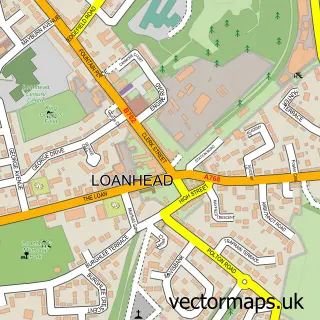
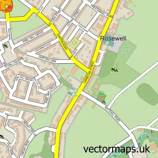
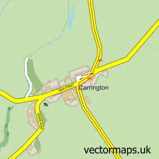
This Bush street map is a detailed vector street map covering a 750m x 750m area. Select a larger area to create and download your own vector street map of Bush.
The 750-metre map sample for Bush covers 41 mapped buildings and approximately 11.5 km of road detail. The immediate area includes 2 GP surgeries within 2 miles and 8 MOT stations within 2 miles. The wider area around Bush features 1 tourism point of interest and 1 campsite within 2 miles. To create a larger or custom map of Bush, the map builder lets you define your own coverage area and download editable SVG, PDF and PNG files.
Create a larger editable map of Bush
Choose any area you need and generate a high-quality vector map instantly. Perfect for print, planning, design, business and personal use.

This Bush street map in Midlothian is available as downloadable SVG, PDF and PNG map files, or as a printed map for planning, business, display, education, local information and design work. You can also create a larger custom map area using the map selector.
What this Bush map sample shows
Bush lies within Midlothian parish, part of Midlothian West ward in the Midlothian local authority area. The postcode geography for this area includes the EH postcode area, the EH26 postcode district and the EH26 0 postcode sector. Residents fall under the Lothian for NHS services.
Local features near Bush
Within 2 milesAmenities and services in and around Bush.
Administrative and postcode information for Bush
The local authority covering Bush is Midlothian, within the county of Midlothian. The settlement lies within Midlothian West ward and Midlothian civil parish. The EH26 postcode district and EH26 0 postcode sector serve the immediate area. NHS provision in the area is delivered through Lothian.
Nearby street map samples around Bush

More street maps in Midlothian
750 metre map area coverage
Boundary, postcode and point of interest information for the 750m x 750m rectangle centred on this sample map.
Boundaries containing map centre
Constituency: Midlothian Co Const
District: Midlothian
Icb: Lothian
Postcode District: EH26
Postcode Sector: EH26 0
Ward: Midlothian West Ward
Nearby boundaries intersecting sample
Postcode District: EH25
Postcode Sector: EH25 9
Postcode coverage
POI category counts
Environmental Conservation Organization: 2
Professional Services: 2
Business: 1
Charity Organization: 1
Clinical Laboratories: 1
Community Services Non Profits: 1
Day Care Preschool: 1
Ev Charging Station: 1
Farming Services: 1
Forest: 1
Sample points of interest
- TomTom
- The Moredun Foundation
- Biobest Laboratories
- Equine Grass Sickness Fund
- Arcadia Nursery at Easter Bush
- BMT Cordah
- Entec UK
- Edinburgh Technopole - WAPG (Pioneer Building)
- SAC Consulting Edinburgh
- Forest Research
- Pentland Science Park
- Angel Biotechnology Holdings
Create a larger editable map of Bush
This sample shows only a 750 metre area. To create a larger map of Bush, use our map builder to choose your own coverage area, add titles and download editable SVG, PDF and PNG files.
Create a custom map of Bush