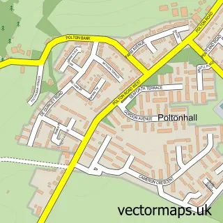
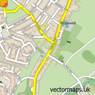
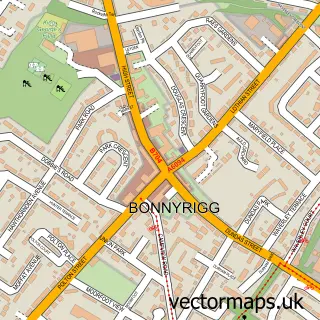
This Loanhead street map is a detailed vector street map covering a 750m x 750m area. Select a larger area to create and download your own vector street map of Loanhead.
The 750-metre map sample for Loanhead covers 407 mapped buildings and approximately 17.2 km of road detail, of which 37 named roads are named. The immediate area includes 1 GP surgery, with 6 within 2 miles, 7 pubs and 1 MOT station, with 13 within 2 miles. The wider area around Loanhead features 4 tourism points of interest, 9 food and drink venues and 1 campsite within 2 miles. To create a larger or custom map of Loanhead, the map builder lets you define your own coverage area and download editable SVG, PDF and PNG files.
Create a larger editable map of Loanhead
Choose any area you need and generate a high-quality vector map instantly. Perfect for print, planning, design, business and personal use.

This Loanhead street map in Midlothian is available as downloadable SVG, PDF and PNG map files, or as a printed map for planning, business, display, education, local information and design work. You can also create a larger custom map area using the map selector.
What this Loanhead map sample shows
Loanhead lies within Midlothian parish, part of Midlothian West ward in the Midlothian local authority area. The postcode geography for this area includes the EH postcode area, the EH20 postcode district and the EH20 9 postcode sector. Residents fall under the Lothian for NHS services.
Local features near Loanhead
Within 2 milesAmenities and services in and around Loanhead.
Administrative and postcode information for Loanhead
The local authority covering Loanhead is Midlothian, within the county of Midlothian. The settlement lies within Midlothian West ward and Midlothian civil parish. The EH20 postcode district and EH20 9 postcode sector serve the immediate area. NHS provision in the area is delivered through Lothian.
Nearby street map samples around Loanhead


More street maps in Midlothian
750 metre map area coverage
Boundary, postcode and point of interest information for the 750m x 750m rectangle centred on this sample map.
Boundaries containing map centre
Constituency: Midlothian Co Const
District: Midlothian
Icb: Lothian
Postcode District: EH20
Postcode Sector: EH20 9
Ward: Midlothian West Ward
Nearby boundaries intersecting sample
No additional intersecting boundaries found.
Postcode coverage
POI category counts
Beauty Salon: 7
Pub: 7
Automotive Repair: 6
Hair Salon: 5
Building Supply Store: 3
Doctor: 3
Indian Restaurant: 3
Package Locker: 3
Professional Services: 3
Sports Club And League: 3
Sample points of interest
- Parrilla Argentinian Grill
- Logy gym
- W and H Edinburgh
- Face 2 Face Financial Planning and Mortgage Solutions
- Lothian bumper repair centre
- Lothian Auto Salvage Ltd
- A P Motorsport
- A1 Auto Breakers
- Car & Commercial Repairs
- DJ Body Styling
- G A Autos
- Treadsafe Autos
Create a larger editable map of Loanhead
This sample shows only a 750 metre area. To create a larger map of Loanhead, use our map builder to choose your own coverage area, add titles and download editable SVG, PDF and PNG files.
Create a custom map of Loanhead