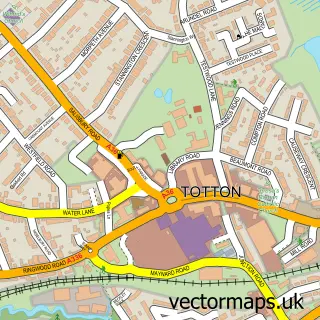
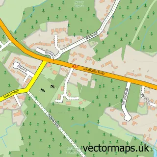
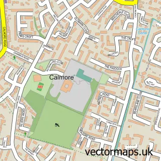
This Rownhams street map is a detailed vector street map covering a 750m x 750m area. Select a larger area to create and download your own vector street map of Rownhams.
The 750-metre map sample for Rownhams covers 431 mapped buildings and approximately 18.4 km of road detail, of which 38 named roads are named. The immediate area includes 1 school, 4 GP surgeries within 2 miles, 2 pubs and 8 MOT stations within 2 miles. The wider area around Rownhams features 2 tourism points of interest, 2 food and drink venues and 1 hotel. To create a larger or custom map of Rownhams, the map builder lets you define your own coverage area and download editable SVG, PDF and PNG files.
Create a larger editable map of Rownhams
Choose any area you need and generate a high-quality vector map instantly. Perfect for print, planning, design, business and personal use.

This Rownhams street map in Hampshire is available as downloadable SVG, PDF and PNG map files, or as a printed map for planning, business, display, education, local information and design work. You can also create a larger custom map area using the map selector.
What this Rownhams map sample shows
Rownhams lies within Nursling And Rownhams Cp parish, part of Chilworth, Nursling & Rownhams ward in the Test Valley District local authority area. The postcode geography for this area includes the SO postcode area, the SO16 postcode district and the SO16 8 postcode sector. Residents fall under the Nhs Hampshire And Isle Of Wight Integrated Care Board for NHS services.
Local features near Rownhams
Within 2 milesAmenities and services in and around Rownhams.
Administrative and postcode information for Rownhams
Rownhams lies within Nursling And Rownhams Cp parish, part of Chilworth, Nursling & Rownhams ward in the Test Valley District local authority area. The postcode geography for this area includes the SO postcode area, the SO16 postcode district and the SO16 8 postcode sector. Residents fall under the Nhs Hampshire And Isle Of Wight Integrated Care Board for NHS services.
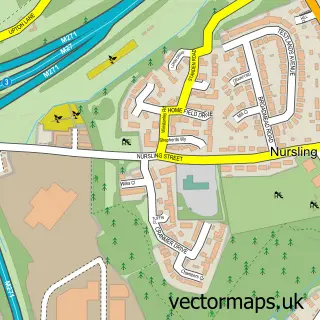
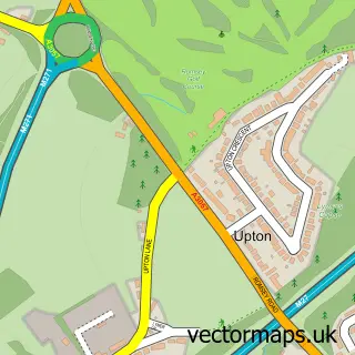
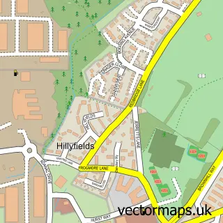
Nearby street map samples around Rownhams

More street maps in Hampshire
750 metre map area coverage
Boundary, postcode and point of interest information for the 750m x 750m rectangle centred on this sample map.
Boundaries containing map centre
Constituency: Romsey and Southampton North Co Const
County: Hampshire County
District: Test Valley District
Icb: NHS Hampshire and Isle of Wight ICB
Parish: Nursling and Rownhams CP
Police Force: hampshire
Postcode District: SO16
Postcode Sector: SO16 8
Ward: Chilworth, Nursling & Rownhams Ward
Nearby boundaries intersecting sample
Constituency: Southampton Test Boro Const
District: City of Southampton (B)
Postcode Sector: SO16 0
Ward: Coxford Ward
Postcode coverage
POI category counts
Beauty Salon: 4
Dance School: 3
Elementary School: 3
Anglican Church: 2
Building Supply Store: 2
Corporate Entertainment Services: 2
Pub: 2
Advertising Agency: 1
Arts And Entertainment: 1
Automotive Services And Repair: 1
Sample points of interest
- Become
- St John's Rownhams
- St. John's Church
- AA Entertainment
- Aptum Biologics
- Enhance Hair & Beauty
- Beauty by. Hollie
- Chop&change
- Inspirations Beauty and Nails 07846 574820
- The Artistic Nail
- Woodsiders Ceilidh And Barn Dance Band
- Digital Terrain Surveys
Create a larger editable map of Rownhams
This sample shows only a 750 metre area. To create a larger map of Rownhams, use our map builder to choose your own coverage area, add titles and download editable SVG, PDF and PNG files.
Create a custom map of Rownhams