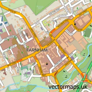
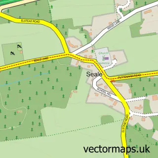
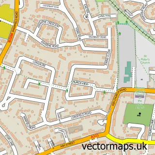
This Runfold street map is a detailed vector street map covering a 750m x 750m area. Select a larger area to create and download your own vector street map of Runfold.
The 750-metre map sample for Runfold covers 122 mapped buildings and approximately 10.9 km of road detail, of which 7 named roads are named. The immediate area includes 1 school, 4 GP surgeries within 2 miles and 22 MOT stations within 2 miles. The wider area around Runfold features 1 tourism point of interest and 3 food and drink venues. To create a larger or custom map of Runfold, the map builder lets you define your own coverage area and download editable SVG, PDF and PNG files.
Create a larger editable map of Runfold
Choose any area you need and generate a high-quality vector map instantly. Perfect for print, planning, design, business and personal use.

This Runfold street map in Surrey is available as downloadable SVG, PDF and PNG map files, or as a printed map for planning, business, display, education, local information and design work. You can also create a larger custom map area using the map selector.
What this Runfold map sample shows
Runfold lies within Farnham Cp parish, part of Farnham Moor Park ward in the Waverley District (B) local authority area. The postcode geography for this area includes the GU postcode area, the GU10 postcode district and the GU10 1 postcode sector. Residents fall under the Nhs Frimley Integrated Care Board for NHS services.
Local features near Runfold
Within 2 milesAmenities and services in and around Runfold.
Administrative and postcode information for Runfold
Runfold lies within Farnham Cp parish, part of Farnham Moor Park ward in the Waverley District (B) local authority area. The postcode geography for this area includes the GU postcode area, the GU10 postcode district and the GU10 1 postcode sector. Residents fall under the Nhs Frimley Integrated Care Board for NHS services.
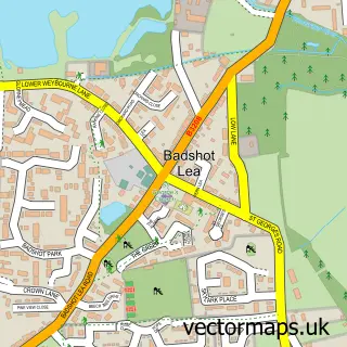
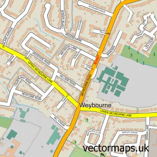
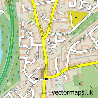
Nearby street map samples around Runfold

More street maps in Surrey
750 metre map area coverage
Boundary, postcode and point of interest information for the 750m x 750m rectangle centred on this sample map.
Boundaries containing map centre
Constituency: Farnham and Bordon Co Const
County: Surrey County
District: Waverley District (B)
Icb: NHS Frimley ICB
Parish: Farnham CP
Police Force: surrey
Postcode District: GU10
Postcode Sector: GU10 1
Ward: Farnham Moor Park Ward
Nearby boundaries intersecting sample
No additional intersecting boundaries found.
Postcode coverage
POI category counts
Furniture Store: 3
Property Management: 3
Car Dealer: 2
Marketing Consultant: 2
Professional Services: 2
Restaurant: 2
Roofing: 2
Used Vintage And Consignment: 2
Accountant: 1
Art Gallery: 1
Sample points of interest
- Accounting Contact
- Life-The Gallery
- Three Peaks Outdoor Pursuits
- Jolly Farmer
- The Secret Beauty Room
- Joe Mitchell Landscaping
- The Coffee Cabin
- Danes Autos
- Thatchers Motors
- Kei's
- Smile IT Ltd.
- Heptagon Events
Create a larger editable map of Runfold
This sample shows only a 750 metre area. To create a larger map of Runfold, use our map builder to choose your own coverage area, add titles and download editable SVG, PDF and PNG files.
Create a custom map of Runfold