Vector Maps logo
Home Why it works Popular maps Districts Samples Customizer Create Your Map
VectorMaps.uk
Home Popular maps Districts Samples Customizer Create Your Map Privacy Disclaimer
Home / UK Maps / Isle of Wight / Ryde Map

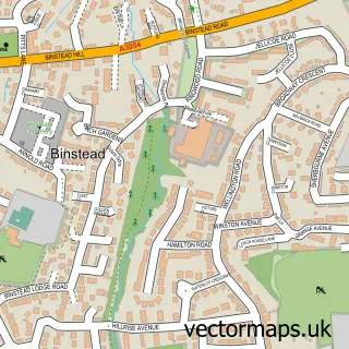
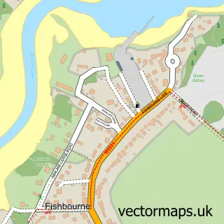
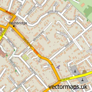
This Ryde street map is a detailed vector street map covering a 750m x 750m area. Select a larger area to create and download your own vector street map of Ryde.

Ryde is a town in Isle Of Wight, in the South East of England. Historically, the area formed part of Hampshire. The settlement falls within the Isle Of Wight parliamentary constituency. It is served by the PO33 postcode district, with PO33 2 as the local

The 750-metre map sample for Ryde covers 400 mapped buildings and approximately 23.3 km of road detail, of which 52 named roads are named. The immediate area includes 1 school, 1 railway station, 1 GP surgery, with 3 within 2 miles and 13 pubs among other local services. The wider area around Ryde features 9 tourism points of interest, 43 food and drink venues and 10 hotels. To create a larger or custom map of Ryde, the map builder lets you define your own coverage area and download editable SVG, PDF and PNG files.

400Buildings
23.31 kmRoads
52Named roads
11,742Residents within 2 miles
Create your own

Create a larger editable map of Ryde

Choose any area you need and generate a high-quality vector map instantly. Perfect for print, planning, design, business and personal use.

Choose any location
Editable SVG files
Any size up to A0
PDF, PNG & more
Instant download
High quality guaranteed
Create My Custom Map
Secure, private & no credit card required
Ryde Vector Street Map
750m Sample
Ryde vector street map sample showing roads, buildings and local features in a 750 metre preview area
Buy Ryde Map Print from £12.95 Buy Ryde Digital Map from £6

This Ryde street map in Isle of Wight is available as downloadable SVG, PDF and PNG map files, or as a printed map for planning, business, display, education, local information and design work. You can also create a larger custom map area using the map selector.

What this Ryde map sample shows

Ryde lies within Ryde Cp parish, part of Ryde North West ward in the Isle Of Wight local authority area. The postcode geography for this area includes the PO postcode area, the PO33 postcode district and the PO33 2 postcode sector. Residents fall under the Nhs Hampshire And Isle Of Wight Integrated Care Board for NHS services.

Local features near Ryde

Within 2 miles

Amenities and services in and around Ryde.

1 Schools
1 Railway stations
1 GP surgeries 3 within 2 miles
5 MOT stations within 2 miles
9 Tourism & leisure
43 Food & drink
13 Pubs
10 Hotels
19 Healthcare POIs

Counts are approximate and based on publicly available data.

Administrative and postcode information for Ryde

The local authority covering Ryde is Isle Of Wight, within the county of Isle Of Wight. The settlement lies within Ryde North West ward and Ryde Cp civil parish. The PO33 postcode district and PO33 2 postcode sector serve the immediate area. NHS provision in the area is delivered through Isle Of Wight Nhs Trust.

Parish Ryde CP
Ward Ryde North West
District / local authority Isle of Wight
County Isle of Wight
Historic county Hampshire
Postcode district PO33
Postcode sector PO33 2
Parliamentary constituency Isle of Wight
Region South East
Country England

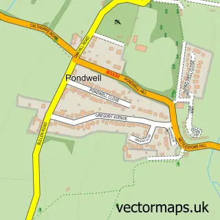
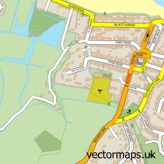
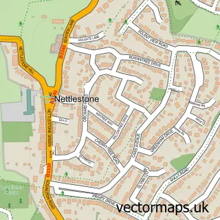
Nearby street map samples around Ryde

Street map sample of Portsmouth, Hampshire Portsmouth City - Hampshire - 5.7 miles Street map sample of Binstead, Isle of Wight Binstead Village - Isle of Wight - 1.0 miles Street map sample of Pondwell, Isle of Wight Pondwell Village - Isle of Wight - 1.7 miles Street map sample of Seaview, Isle of Wight Seaview Village - Isle of Wight - 2.1 miles Street map sample of Nettlestone, Isle of Wight Nettlestone Village - Isle of Wight - 2.3 miles Street map sample of Fishbourne, Isle of Wight Fishbourne Village - Isle of Wight - 2.4 miles Street map sample of Havenstreet, Isle of Wight Havenstreet Village - Isle of Wight - 2.4 miles Street map sample of St Helens, Isle of Wight St Helens Village - Isle of Wight - 3.0 miles Street map sample of Wootton, Isle of Wight Wootton Village - Isle of Wight - 3.2 miles Street map sample of Bembridge, Isle of Wight Bembridge Village - Isle of Wight - 4.4 miles

More street maps in Isle of Wight

Street map sample of Binstead, Isle of Wight Binstead Village - 1.0 miles Street map sample of Pondwell, Isle of Wight Pondwell Village - 1.7 miles Street map sample of Seaview, Isle of Wight Seaview Village - 2.1 miles Street map sample of Nettlestone, Isle of Wight Nettlestone Village - 2.3 miles Street map sample of Fishbourne, Isle of Wight Fishbourne Village - 2.4 miles

750 metre map area coverage

Boundary, postcode and point of interest information for the 750m x 750m rectangle centred on this sample map.

Boundaries containing map centre

Constituency: Isle of Wight East Co Const

District: Isle of Wight

Icb: NHS Hampshire and Isle of Wight ICB

Parish: Ryde CP

Police Force: hampshire

Postcode District: PO33

Postcode Sector: PO33 2

Nearby boundaries intersecting sample

Postcode Sector: PO33 1

Postcode coverage

PO33 PO33 2 PO33 1

POI category counts

Hair Salon: 21

Flowers And Gifts Shop: 15

Clothing Store: 13

Pub: 13

Cafe: 11

Coffee Shop: 11

Professional Services: 11

Dentist: 10

Hotel: 10

Antique Store: 9

Sample points of interest

  • Ms Friday Accountancy Services Accountant
  • Evolution Advertising Advertising Agency
  • B M Bailey Alternative Medicine
  • Charles Tully Alternative Medicine
  • Biskra House Licensed Restaurant American Restaurant
  • Ryde Leisure Amusement Park
  • RSPCA Animal Shelter
  • ANI's Collectables Antique Store
  • Atelier Antique Store
  • Chic Antique Antique Store
  • Deja Vu Antique Store
  • Island Antiques Antique Store

Create a larger editable map of Ryde

This sample shows only a 750 metre area. To create a larger map of Ryde, use our map builder to choose your own coverage area, add titles and download editable SVG, PDF and PNG files.

Create a custom map of Ryde

Phone 01751 473136 | Copyright Vectormaps.uk 2026

Samples Customizer Privacy Disclaimer
Ryde Vector Street Map
Ryde enlarged street map sample showing a 750 metre preview area