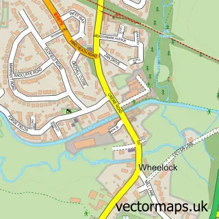
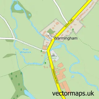
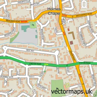
This Sandbach street map is a detailed vector street map covering a 750m x 750m area. Select a larger area to create and download your own vector street map of Sandbach.
The 750-metre map sample for Sandbach covers 394 mapped buildings and approximately 23.0 km of road detail, of which 60 named roads are named. The immediate area includes 1 school, 1 GP surgery, 14 pubs and 1 MOT station, with 9 within 2 miles. The wider area around Sandbach features 4 tourism points of interest and 31 food and drink venues. To create a larger or custom map of Sandbach, the map builder lets you define your own coverage area and download editable SVG, PDF and PNG files.
Create a larger editable map of Sandbach
Choose any area you need and generate a high-quality vector map instantly. Perfect for print, planning, design, business and personal use.

This Sandbach street map in Cheshire is available as downloadable SVG, PDF and PNG map files, or as a printed map for planning, business, display, education, local information and design work. You can also create a larger custom map area using the map selector.
What this Sandbach map sample shows
Sandbach lies within Sandbach Cp parish, part of Sandbach Town ward in the Cheshire East (B) local authority area. The postcode geography for this area includes the CW postcode area, the CW11 postcode district and the CW11 1 postcode sector. Residents fall under the Nhs Cheshire And Merseyside Integrated Care Board for NHS services.
Local features near Sandbach
Within 2 milesAmenities and services in and around Sandbach.
Administrative and postcode information for Sandbach
The local authority covering Sandbach is Cheshire East (B), within the county of Cheshire. The settlement lies within Sandbach Town ward and Sandbach Cp civil parish. The CW11 postcode district and CW11 1 postcode sector serve the immediate area. NHS provision in the area is delivered through Mid Cheshire Hospitals Nhs Foundation Trust.
Nearby street map samples around Sandbach

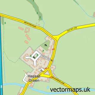
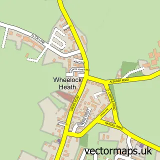
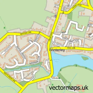
More street maps in Cheshire
750 metre map area coverage
Boundary, postcode and point of interest information for the 750m x 750m rectangle centred on this sample map.
Boundaries containing map centre
Constituency: Congleton Co Const
District: Cheshire East (B)
Icb: NHS Cheshire and Merseyside ICB
Parish: Sandbach CP
Police Force: cheshire
Postcode District: CW11
Postcode Sector: CW11 1
Ward: Sandbach Town Ward
Nearby boundaries intersecting sample
Postcode Sector: CW11 4
Ward: Sandbach Heath and East Ward
Postcode coverage
POI category counts
Hair Salon: 23
Beauty Salon: 21
Pub: 13
Flowers And Gifts Shop: 9
Professional Services: 9
Barber: 8
Cafe: 8
Charity Organization: 7
Financial Service: 7
Real Estate Agent: 7
Sample points of interest
- Bruce Marshall & Co
- John Greenall & Co
- John Greenall & Co.
- Knight Brown Accountants
- TaxAssist Accountants
- VSS Accounting Services
- Changes Plus
- Brightstone Clinic
- Laura Stannard Medical Herbalist
- The Cheshire Health Clinic
- Tropical Topaz
- Sandbach Judo Club
Create a larger editable map of Sandbach
This sample shows only a 750 metre area. To create a larger map of Sandbach, use our map builder to choose your own coverage area, add titles and download editable SVG, PDF and PNG files.
Create a custom map of Sandbach