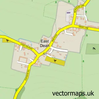
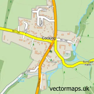
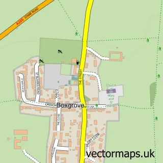
This Singleton street map is a detailed vector street map covering a 750m x 750m area. Select a larger area to create and download your own vector street map of Singleton.
The 750-metre map sample for Singleton covers 148 mapped buildings and approximately 10.2 km of road detail, of which 3 named roads are named. The immediate area includes 1 school and 1 pub. The wider area around Singleton features 2 tourism points of interest and 2 food and drink venues. To create a larger or custom map of Singleton, the map builder lets you define your own coverage area and download editable SVG, PDF and PNG files.
Create a larger editable map of Singleton
Choose any area you need and generate a high-quality vector map instantly. Perfect for print, planning, design, business and personal use.

This Singleton street map in West Sussex is available as downloadable SVG, PDF and PNG map files, or as a printed map for planning, business, display, education, local information and design work. You can also create a larger custom map area using the map selector.
What this Singleton map sample shows
Singleton lies within Singleton Cp parish, part of Goodwood ward in the Chichester District local authority area. The postcode geography for this area includes the PO postcode area, the PO18 postcode district and the PO18 0 postcode sector. Residents fall under the Nhs Sussex Integrated Care Board for NHS services.
Local features near Singleton
Within 2 milesAmenities and services in and around Singleton.
Administrative and postcode information for Singleton
Singleton lies within Singleton Cp parish, part of Goodwood ward in the Chichester District local authority area. The postcode geography for this area includes the PO postcode area, the PO18 postcode district and the PO18 0 postcode sector. Residents fall under the Nhs Sussex Integrated Care Board for NHS services.
Nearby street map samples around Singleton

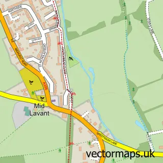
More street maps in West Sussex
750 metre map area coverage
Boundary, postcode and point of interest information for the 750m x 750m rectangle centred on this sample map.
Boundaries containing map centre
Constituency: Arundel and South Downs Co Const
County: West Sussex County
District: Chichester District
Icb: NHS Surrey and Sussex ICB
Parish: Singleton CP
Police Force: sussex
Postcode District: PO18
Postcode Sector: PO18 0
Ward: Goodwood Ward
Nearby boundaries intersecting sample
No additional intersecting boundaries found.
Postcode coverage
POI category counts
Assisted Living Facility: 2
Landscaping: 2
Anglican Church: 1
Attractions And Activities: 1
Bed And Breakfast: 1
Building Supply Store: 1
Cafe: 1
Catholic Church: 1
Church Cathedral: 1
History Museum: 1
Sample points of interest
- The Blessed Virgin Mary
- The Old Rectory
- The Old Rectory Community Housing Limited
- Drovers Estate
- Rose Cottage
- J Taylor Scaffolding
- Hannah’s At Singleton
- St Marys Church, Singleton.
- Singleton East Dean & West Dean Parish Churches
- Weald & Downland Living Museum
- Handsome Homes and Gardens
- Seasons Landscapes and Log Merchants
Create a larger editable map of Singleton
This sample shows only a 750 metre area. To create a larger map of Singleton, use our map builder to choose your own coverage area, add titles and download editable SVG, PDF and PNG files.
Create a custom map of Singleton