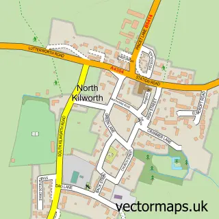
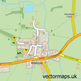
This South Kilworth street map is a detailed vector street map covering a 750m x 750m area. Select a larger area to create and download your own vector street map of South Kilworth.
The 750-metre map sample for South Kilworth covers 137 mapped buildings and approximately 18.8 km of road detail, of which 9 named roads are named. The immediate area includes 1 school, 1 pub and 1 MOT station within 2 miles. The wider area around South Kilworth features 1 food and drink venue. To create a larger or custom map of South Kilworth, the map builder lets you define your own coverage area and download editable SVG, PDF and PNG files.
Create a larger editable map of South Kilworth
Choose any area you need and generate a high-quality vector map instantly. Perfect for print, planning, design, business and personal use.

This South Kilworth street map in Leicestershire is available as downloadable SVG, PDF and PNG map files, or as a printed map for planning, business, display, education, local information and design work. You can also create a larger custom map area using the map selector.
What this South Kilworth map sample shows
South Kilworth lies within South Kilworth Cp parish, part of Bosworth ward in the Harborough District local authority area. The postcode geography for this area includes the LE postcode area, the LE17 postcode district and the LE17 6 postcode sector. Residents fall under the Nhs Leicester, Leicestershire And Rutland Integrated Care Board for NHS services.
Local features near South Kilworth
Within 2 milesAmenities and services in and around South Kilworth.
Administrative and postcode information for South Kilworth
South Kilworth lies within South Kilworth Cp parish, part of Bosworth ward in the Harborough District local authority area. The postcode geography for this area includes the LE postcode area, the LE17 postcode district and the LE17 6 postcode sector. Residents fall under the Nhs Leicester, Leicestershire And Rutland Integrated Care Board for NHS services.
Nearby street map samples around South Kilworth


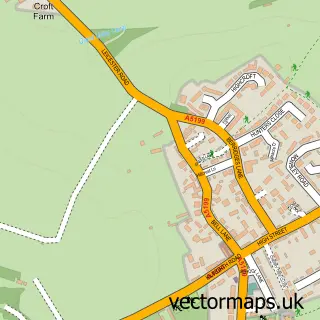
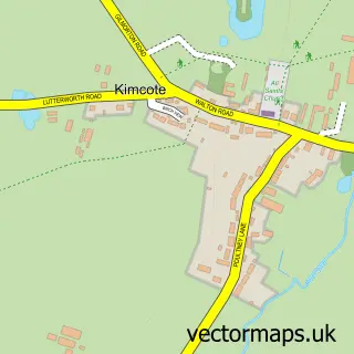
More street maps in Leicestershire
750 metre map area coverage
Boundary, postcode and point of interest information for the 750m x 750m rectangle centred on this sample map.
Boundaries containing map centre
Constituency: South Leicestershire Co Const
County: Leicestershire County
District: Harborough District
Icb: NHS Leicester Leicestershire and Rutland ICB
Parish: South Kilworth CP
Police Force: leicestershire
Postcode District: LE17
Postcode Sector: LE17 6
Ward: Bosworth Ward
Nearby boundaries intersecting sample
No additional intersecting boundaries found.
Postcode coverage
POI category counts
Elementary School: 2
Pharmaceutical Companies: 2
Anglican Church: 1
Beauty Salon: 1
Bed And Breakfast: 1
Butcher Shop: 1
Corporate Entertainment Services: 1
Event Planning: 1
Gardener: 1
Hvac Services: 1
Sample points of interest
- St Nicholas', South Kilworth
- Bliss & Beauty
- The Hollies Bed and Breakfast
- Joseph Morris Butchers
- Easy Tiger Corporate Events
- South Kilworth C of E Primary School
- South Kilworth Church of England Primary School
- Tiger Team Events
- The Plant Yard Bulrush Nurseries, Walcote road, South Kilworth LE17 6EQ
- Home Heating UK
- Graham Clarkson Associates
- Bliss & Beauty
Create a larger editable map of South Kilworth
This sample shows only a 750 metre area. To create a larger map of South Kilworth, use our map builder to choose your own coverage area, add titles and download editable SVG, PDF and PNG files.
Create a custom map of South Kilworth