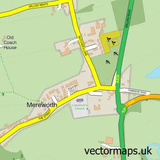
This St Mary's Platt street map is a detailed vector street map covering a 750m x 750m area. Select a larger area to create and download your own vector street map of St Mary's Platt.
The 750-metre map sample for St Mary's Platt covers 282 mapped buildings and approximately 10.6 km of road detail, of which 16 named roads are named. The immediate area includes 1 GP surgery within 2 miles and 5 MOT stations within 2 miles. The wider area around St Mary's Platt features 2 tourism points of interest, 1 food and drink venue and 1 campsite within 2 miles. To create a larger or custom map of St Mary's Platt, the map builder lets you define your own coverage area and download editable SVG, PDF and PNG files.
Create a larger editable map of St Mary's Platt
Choose any area you need and generate a high-quality vector map instantly. Perfect for print, planning, design, business and personal use.

This St Mary's Platt street map in Kent is available as downloadable SVG, PDF and PNG map files, or as a printed map for planning, business, display, education, local information and design work. You can also create a larger custom map area using the map selector.
What this St Mary's Platt map sample shows
St Mary's Platt lies within Platt Cp parish, part of Borough Green And Long Mill ward in the Tonbridge And Malling District (B) local authority area. The postcode geography for this area includes the TN postcode area, the TN15 postcode district and the TN15 8 postcode sector. Residents fall under the Nhs Kent And Medway Integrated Care Board for NHS services.
Local features near St Mary's Platt
Within 2 milesAmenities and services in and around St Mary's Platt.
Administrative and postcode information for St Mary's Platt
The local authority covering St Mary's Platt is Tonbridge And Malling District (B), within the county of Kent. The settlement lies within Borough Green And Long Mill ward and Platt Cp civil parish. The TN15 postcode district and TN15 8 postcode sector serve the immediate area. NHS provision in the area is delivered through Maidstone And Tunbridge Wells Nhs Trust.
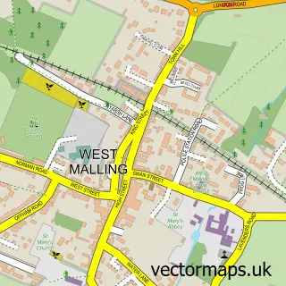
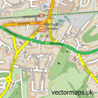
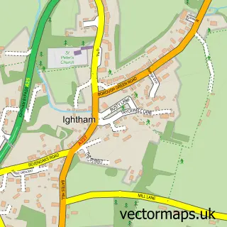
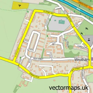
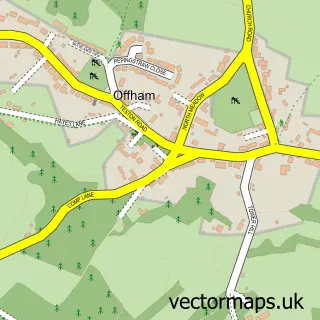
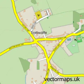
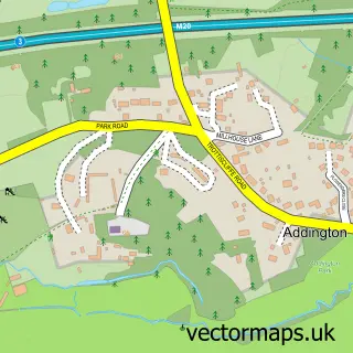
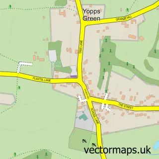
Nearby street map samples around St Mary's Platt

More street maps in Kent
750 metre map area coverage
Boundary, postcode and point of interest information for the 750m x 750m rectangle centred on this sample map.
Boundaries containing map centre
Constituency: Tonbridge Co Const
County: Kent County
District: Tonbridge and Malling District (B)
Icb: NHS Kent and Medway ICB
Parish: Platt CP
Police Force: kent
Postcode District: TN15
Postcode Sector: TN15 8
Ward: Borough Green & Platt Ward
Nearby boundaries intersecting sample
No additional intersecting boundaries found.
Postcode coverage
POI category counts
Attractions And Activities: 2
Gardener: 2
Anglican Church: 1
Antique Store: 1
Automotive Repair: 1
Beauty And Spa: 1
Beauty Salon: 1
British Restaurant: 1
Building Supply Store: 1
Church Cathedral: 1
Sample points of interest
- St Mary the Virgin, Platt
- Marchand
- King George's Field
- Stonehouse Field
- MOT Tester Training
- Lbd Beauty
- Beaubeauty
- The Blue Anchor
- Domestic Cleaning Services
- St Mary's Church
- The Stay and Play Cafe
- Platt Church Of England Primary School
Create a larger editable map of St Mary's Platt
This sample shows only a 750 metre area. To create a larger map of St Mary's Platt, use our map builder to choose your own coverage area, add titles and download editable SVG, PDF and PNG files.
Create a custom map of St Mary's Platt