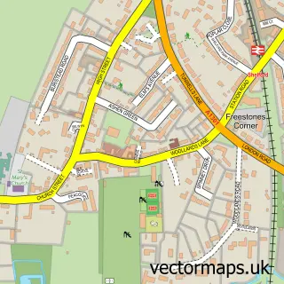
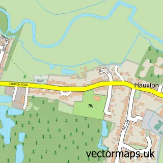
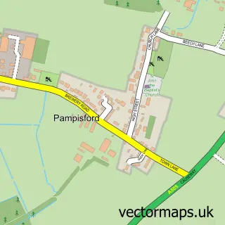
This Stapleford street map is a detailed vector street map covering a 750m x 750m area. Select a larger area to create and download your own vector street map of Stapleford.
The 750-metre map sample for Stapleford covers 403 mapped buildings and approximately 13.7 km of road detail, of which 27 named roads are named. The immediate area includes 1 school, 3 pubs and 8 MOT stations within 2 miles. The wider area around Stapleford features 1 tourism point of interest, 3 food and drink venues and 1 campsite within 2 miles. To create a larger or custom map of Stapleford, the map builder lets you define your own coverage area and download editable SVG, PDF and PNG files.
Create a larger editable map of Stapleford
Choose any area you need and generate a high-quality vector map instantly. Perfect for print, planning, design, business and personal use.

This Stapleford street map in Cambridgeshire is available as downloadable SVG, PDF and PNG map files, or as a printed map for planning, business, display, education, local information and design work. You can also create a larger custom map area using the map selector.
What this Stapleford map sample shows
Stapleford lies within Stapleford Cp parish, part of Shelford ward in the South Cambridgeshire District local authority area. The postcode geography for this area includes the CB postcode area, the CB22 postcode district and the CB22 5 postcode sector. Residents fall under the Nhs Cambridgeshire And Peterborough Integrated Care Board for NHS services.
Local features near Stapleford
Within 2 milesAmenities and services in and around Stapleford.
Administrative and postcode information for Stapleford
Stapleford lies within Stapleford Cp parish, part of Shelford ward in the South Cambridgeshire District local authority area. The postcode geography for this area includes the CB postcode area, the CB22 postcode district and the CB22 5 postcode sector. Residents fall under the Nhs Cambridgeshire And Peterborough Integrated Care Board for NHS services.
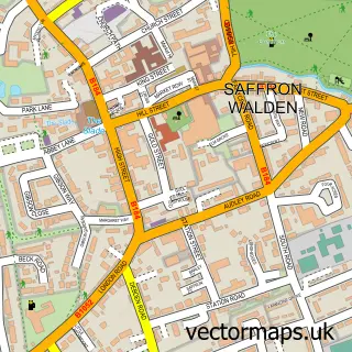
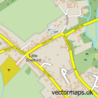
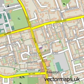
Nearby street map samples around Stapleford

More street maps in Cambridgeshire
750 metre map area coverage
Boundary, postcode and point of interest information for the 750m x 750m rectangle centred on this sample map.
Boundaries containing map centre
Constituency: South Cambridgeshire Co Const
County: Cambridgeshire County
District: South Cambridgeshire District
Icb: NHS Central East ICB
Parish: Stapleford CP
Police Force: cambridgeshire
Postcode District: CB22
Postcode Sector: CB22 5
Ward: Shelford Ward
Nearby boundaries intersecting sample
Parish: Sawston CP
Ward: Sawston Ward
Postcode coverage
POI category counts
Pub: 3
Advertising Agency: 2
Convenience Store: 2
Driving School: 2
Travel Services: 2
Anglican Church: 1
Barber: 1
Beauty Salon: 1
Building Contractor: 1
Building Supply Store: 1
Sample points of interest
- CBA Design
- Mobas
- St Andrew, Stapleford
- Neils Gents Hairstylists
- Sofie Georgia Skin Care, Beauty & Aesthetics
- Sterling Cleaning Services
- Travis Perkins
- Coney Wood Candles
- Stapleford Choral Society
- St Andrews
- Cambridge Joint Playschemes
- Pc Doctor
Create a larger editable map of Stapleford
This sample shows only a 750 metre area. To create a larger map of Stapleford, use our map builder to choose your own coverage area, add titles and download editable SVG, PDF and PNG files.
Create a custom map of Stapleford