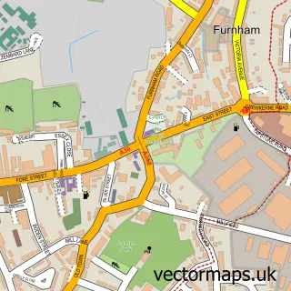
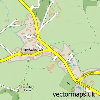
This Tatworth street map is a detailed vector street map covering a 750m x 750m area. Select a larger area to create and download your own vector street map of Tatworth.
The 750-metre map sample for Tatworth covers 296 mapped buildings and approximately 16.5 km of road detail, of which 22 named roads are named. The immediate area includes 1 GP surgery within 2 miles, 1 pub and 5 MOT stations within 2 miles. The wider area around Tatworth features 1 food and drink venue, 1 hotel and 1 campsite within 2 miles. To create a larger or custom map of Tatworth, the map builder lets you define your own coverage area and download editable SVG, PDF and PNG files.
Create a larger editable map of Tatworth
Choose any area you need and generate a high-quality vector map instantly. Perfect for print, planning, design, business and personal use.

This Tatworth street map in Somerset is available as downloadable SVG, PDF and PNG map files, or as a printed map for planning, business, display, education, local information and design work. You can also create a larger custom map area using the map selector.
What this Tatworth map sample shows
Tatworth lies within Tatworth And Forton Cp parish, part of Blackdown & Tatworth ward in the Somerset local authority area. The postcode geography for this area includes the TA postcode area, the TA20 postcode district and the TA20 2 postcode sector. Residents fall under the Nhs Somerset Integrated Care Board for NHS services.
Local features near Tatworth
Within 2 milesAmenities and services in and around Tatworth.
Administrative and postcode information for Tatworth
The local authority covering Tatworth is Somerset, within the county of Somerset. The settlement lies within Blackdown & Tatworth ward and Tatworth And Forton Cp civil parish. The TA20 postcode district and TA20 2 postcode sector serve the immediate area. NHS provision in the area is delivered through Somerset Nhs Foundation Trust.
Nearby street map samples around Tatworth

More street maps in Somerset
750 metre map area coverage
Boundary, postcode and point of interest information for the 750m x 750m rectangle centred on this sample map.
Boundaries containing map centre
Constituency: Yeovil Co Const
District: Somerset
Icb: NHS Somerset ICB
Parish: Tatworth and Forton CP
Police Force: avon and somerset
Postcode District: TA20
Postcode Sector: TA20 2
Nearby boundaries intersecting sample
No additional intersecting boundaries found.
Postcode coverage
POI category counts
Anglican Church: 1
Building Supply Store: 1
Church Cathedral: 1
Food Beverage Service Distribution: 1
Handyman: 1
Hotel: 1
Information Technology Company: 1
Nursery And Gardening: 1
Pizza Restaurant: 1
Pub: 1
Sample points of interest
- St John the Evangelist
- Aston Construction
- St John's Church
- Fine Choice Foods
- Skilful Handyman Ltd
- Myrtle Cottage
- Somerset Design
- Bee Happy Plants and Seeds
- Chianti Crust - Pizzaria and Tinto Vinyard
- Ye Olde Poppe Inn
- Tatworth Pre-School
Create a larger editable map of Tatworth
This sample shows only a 750 metre area. To create a larger map of Tatworth, use our map builder to choose your own coverage area, add titles and download editable SVG, PDF and PNG files.
Create a custom map of Tatworth