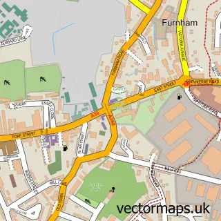
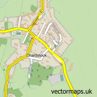
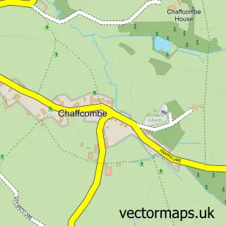
This South Chard street map is a detailed vector street map covering a 750m x 750m area. Select a larger area to create and download your own vector street map of South Chard.
The 750-metre map sample for South Chard covers 269 mapped buildings and approximately 14.1 km of road detail, of which 19 named roads are named. The immediate area includes 3 MOT stations within 2 miles. The wider area around South Chard features 1 campsite within 2 miles. To create a larger or custom map of South Chard, the map builder lets you define your own coverage area and download editable SVG, PDF and PNG files.
Create a larger editable map of South Chard
Choose any area you need and generate a high-quality vector map instantly. Perfect for print, planning, design, business and personal use.

This South Chard street map in Somerset is available as downloadable SVG, PDF and PNG map files, or as a printed map for planning, business, display, education, local information and design work. You can also create a larger custom map area using the map selector.
What this South Chard map sample shows
South Chard lies within Tatworth And Forton Cp parish, part of Blackdown & Tatworth ward in the Somerset local authority area. The postcode geography for this area includes the TA postcode area, the TA20 postcode district and the TA20 2 postcode sector. Residents fall under the Nhs Somerset Integrated Care Board for NHS services.
Local features near South Chard
Within 2 milesAmenities and services in and around South Chard.
Administrative and postcode information for South Chard
The local authority covering South Chard is Somerset, within the county of Somerset. The settlement lies within Blackdown & Tatworth ward and Tatworth And Forton Cp civil parish. The TA20 postcode district and TA20 2 postcode sector serve the immediate area. NHS provision in the area is delivered through Somerset Nhs Foundation Trust.
Nearby street map samples around South Chard

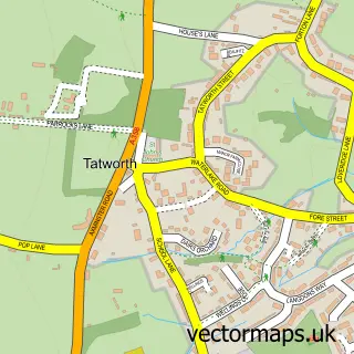
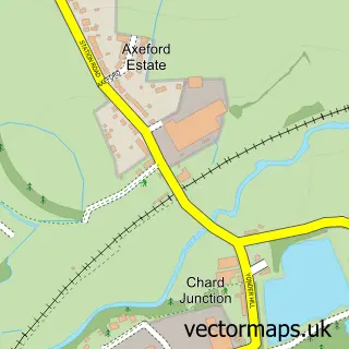
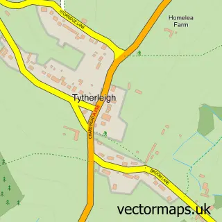
More street maps in Somerset
750 metre map area coverage
Boundary, postcode and point of interest information for the 750m x 750m rectangle centred on this sample map.
Boundaries containing map centre
Constituency: Yeovil Co Const
District: Somerset
Icb: NHS Somerset ICB
Parish: Tatworth and Forton CP
Police Force: avon and somerset
Postcode District: TA20
Postcode Sector: TA20 2
Nearby boundaries intersecting sample
No additional intersecting boundaries found.
Postcode coverage
POI category counts
Assisted Living Facility: 2
Convenience Store: 2
Driving School: 2
Post Office: 2
Preschool: 2
Beauty Salon: 1
Building Contractor: 1
Church Cathedral: 1
Community Center: 1
Community Services Non Profits: 1
Sample points of interest
- Perry Court
- South Somerset Homes
- Elegance Relaxation & Beauty
- Peter Trotter the Window Specialist
- South Chard Church
- Tatworth Memorial Hall
- Tatworth Amateur Pantomime Society
- Martin Lillywhite Tiling
- McColl's
- Morrisons Daily
- Andrew Parsons Driving School
- Andy Aston
Create a larger editable map of South Chard
This sample shows only a 750 metre area. To create a larger map of South Chard, use our map builder to choose your own coverage area, add titles and download editable SVG, PDF and PNG files.
Create a custom map of South Chard