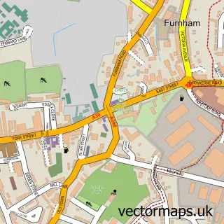
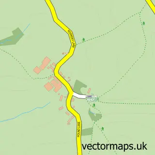
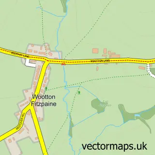
This Thorncombe street map is a detailed vector street map covering a 750m x 750m area. Select a larger area to create and download your own vector street map of Thorncombe.
The 750-metre map sample for Thorncombe covers 159 mapped buildings and approximately 8.9 km of road detail, of which 8 named roads are named. The immediate area includes 1 school, 1 pub and 2 MOT stations within 2 miles. The wider area around Thorncombe features 1 food and drink venue. To create a larger or custom map of Thorncombe, the map builder lets you define your own coverage area and download editable SVG, PDF and PNG files.
Create a larger editable map of Thorncombe
Choose any area you need and generate a high-quality vector map instantly. Perfect for print, planning, design, business and personal use.

This Thorncombe street map in Dorset is available as downloadable SVG, PDF and PNG map files, or as a printed map for planning, business, display, education, local information and design work. You can also create a larger custom map area using the map selector.
What this Thorncombe map sample shows
Thorncombe lies within Thorncombe Cp parish, part of Marshwood Vale ward in the Dorset local authority area. The postcode geography for this area includes the TA postcode area, the TA20 postcode district and the TA20 4 postcode sector. Residents fall under the Nhs Dorset Integrated Care Board for NHS services.
Local features near Thorncombe
Within 2 milesAmenities and services in and around Thorncombe.
Administrative and postcode information for Thorncombe
The local authority covering Thorncombe is Dorset, within the county of Dorset. The settlement lies within Marshwood Vale ward and Thorncombe Cp civil parish. The TA20 postcode district and TA20 4 postcode sector serve the immediate area. NHS provision in the area is delivered through Dorset County Hospital Nhs Foundation Trust.
Nearby street map samples around Thorncombe

More street maps in Dorset
750 metre map area coverage
Boundary, postcode and point of interest information for the 750m x 750m rectangle centred on this sample map.
Boundaries containing map centre
Constituency: West Dorset Co Const
District: Dorset
Icb: NHS Dorset ICB
Parish: Thorncombe CP
Police Force: dorset
Postcode District: TA20
Postcode Sector: TA20 4
Ward: Marshwood Vale Ward
Nearby boundaries intersecting sample
No additional intersecting boundaries found.
Postcode coverage
POI category counts
Elementary School: 2
Anglican Church: 1
Charity Organization: 1
Clothing Store: 1
Convenience Store: 1
Event Technology Service: 1
Livestock Feed And Supply Store: 1
Marketing Consultant: 1
Post Office: 1
Pub: 1
Sample points of interest
- The Blessed Virgin Mary, Thorncombe
- Across the Divide
- Workwear Pro Direct
- Thorncombe Village Shop
- St Mary's C of E Primary School
- Thorncombe St. Mary's CE Primary Academy
- Cooper Events
- Pet Calls
- Duncan Phillips PR & Advertising
- Post Office
- Applebarn Cottage
- Thorncombe Community Shop
Create a larger editable map of Thorncombe
This sample shows only a 750 metre area. To create a larger map of Thorncombe, use our map builder to choose your own coverage area, add titles and download editable SVG, PDF and PNG files.
Create a custom map of Thorncombe