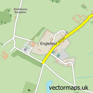
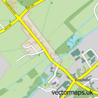
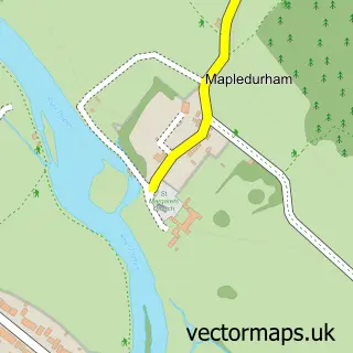
This Tidmarsh street map is a detailed vector street map covering a 750m x 750m area. Select a larger area to create and download your own vector street map of Tidmarsh.
The 750-metre map sample for Tidmarsh covers 145 mapped buildings and approximately 8.5 km of road detail, of which 5 named roads are named. The immediate area includes 2 GP surgeries within 2 miles, 1 pub and 2 MOT stations within 2 miles. The wider area around Tidmarsh features 1 food and drink venue. To create a larger or custom map of Tidmarsh, the map builder lets you define your own coverage area and download editable SVG, PDF and PNG files.
Create a larger editable map of Tidmarsh
Choose any area you need and generate a high-quality vector map instantly. Perfect for print, planning, design, business and personal use.

This Tidmarsh street map in Berkshire is available as downloadable SVG, PDF and PNG map files, or as a printed map for planning, business, display, education, local information and design work. You can also create a larger custom map area using the map selector.
What this Tidmarsh map sample shows
Tidmarsh lies within Tidmarsh Cp parish, part of Pangbourne ward in the West Berkshire local authority area. The postcode geography for this area includes the RG postcode area, the RG8 postcode district and the RG8 8 postcode sector. Residents fall under the Nhs Buckinghamshire, Oxfordshire And Berkshire West Integrated Care Board for NHS services.
Local features near Tidmarsh
Within 2 milesAmenities and services in and around Tidmarsh.
Administrative and postcode information for Tidmarsh
The local authority covering Tidmarsh is West Berkshire, within the county of Berkshire. The settlement lies within Pangbourne ward and Tidmarsh Cp civil parish. The RG8 postcode district and RG8 8 postcode sector serve the immediate area. NHS provision in the area is delivered through Royal Berkshire Nhs Foundation Trust.
Nearby street map samples around Tidmarsh

More street maps in Berkshire
750 metre map area coverage
Boundary, postcode and point of interest information for the 750m x 750m rectangle centred on this sample map.
Boundaries containing map centre
Constituency: Reading West and Mid Berkshire Co Const
District: West Berkshire
Icb: NHS Thames Valley ICB
Parish: Tidmarsh CP
Police Force: thames valley
Postcode District: RG8
Postcode Sector: RG8 8
Ward: Pangbourne Ward
Nearby boundaries intersecting sample
No additional intersecting boundaries found.
Postcode coverage
POI category counts
Automotive Repair: 2
Church Cathedral: 2
Anglican Church: 1
Business Management Services: 1
Community Center: 1
Computer Store: 1
Construction Services: 1
Farm: 1
Liquor Store: 1
Professional Services: 1
Sample points of interest
- St Laurence
- A 1 Scrap Cars Wanted for Cash
- ELV Recovery
- Screen Works Portable Projection Screens Hire
- Bishop of Reading
- St Laurence Church
- Tidmarsh Village Hall
- Futura Retail Solutions Ltd.
- 1st Scaffolding Berkshire Limited
- Sulham and Tidmarsh Woods and Meadows
- MWH Wine Merchants
- Green Economics Institute
Create a larger editable map of Tidmarsh
This sample shows only a 750 metre area. To create a larger map of Tidmarsh, use our map builder to choose your own coverage area, add titles and download editable SVG, PDF and PNG files.
Create a custom map of Tidmarsh