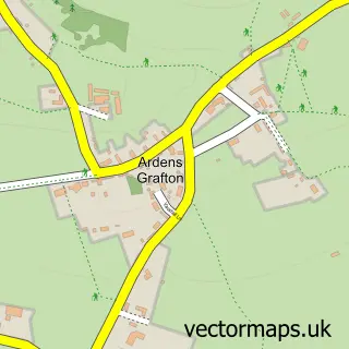
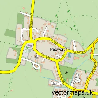
This Welford-on-Avon street map is a detailed vector street map covering a 750m x 750m area. Select a larger area to create and download your own vector street map of Welford-on-Avon.
The 750-metre map sample for Welford-on-Avon covers 364 mapped buildings and approximately 21.3 km of road detail, of which 26 named roads are named. The immediate area includes 1 school, 2 pubs and 1 MOT station within 2 miles. The wider area around Welford-on-Avon features 2 food and drink venues and 1 hotel. To create a larger or custom map of Welford-on-Avon, the map builder lets you define your own coverage area and download editable SVG, PDF and PNG files.
Create a larger editable map of Welford-on-Avon
Choose any area you need and generate a high-quality vector map instantly. Perfect for print, planning, design, business and personal use.

This Welford-on-Avon street map in Warwickshire is available as downloadable SVG, PDF and PNG map files, or as a printed map for planning, business, display, education, local information and design work. You can also create a larger custom map area using the map selector.
What this Welford-on-Avon map sample shows
Welford-on-Avon lies within Welford-On-Avon Cp parish, part of Welford-On-Avon ward in the Stratford-On-Avon District local authority area. The postcode geography for this area includes the CV postcode area, the CV37 postcode district and the CV37 8 postcode sector. Residents fall under the Nhs Coventry And Warwickshire Integrated Care Board for NHS services.
Local features near Welford-on-Avon
Within 2 milesAmenities and services in and around Welford-on-Avon.
Administrative and postcode information for Welford-on-Avon
The local authority covering Welford-on-Avon is Stratford-On-Avon District, within the county of Warwickshire. The settlement lies within Welford-On-Avon ward and Welford-On-Avon Cp civil parish. The CV37 postcode district and CV37 8 postcode sector serve the immediate area. NHS provision in the area is delivered through South Warwickshire University Nhs Foundation Trust.
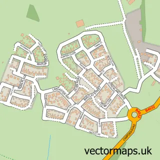
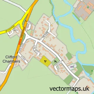
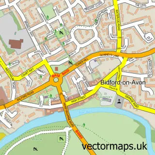
Nearby street map samples around Welford-on-Avon

More street maps in Warwickshire
750 metre map area coverage
Boundary, postcode and point of interest information for the 750m x 750m rectangle centred on this sample map.
Boundaries containing map centre
Constituency: Stratford-on-Avon Co Const
County: Warwickshire County
District: Stratford-on-Avon District
Icb: NHS Coventry and Warwickshire ICB
Parish: Welford-on-Avon CP
Police Force: warwickshire
Postcode District: CV37
Postcode Sector: CV37 8
Ward: Welford-on-Avon Ward
Nearby boundaries intersecting sample
No additional intersecting boundaries found.
Postcode coverage
POI category counts
Convenience Store: 4
Butcher Shop: 3
Bakery: 2
Beauty Salon: 2
Clothing Store: 2
Contractor: 2
Elementary School: 2
Pub: 2
Adult Education: 1
Anglican Church: 1
Sample points of interest
- Stratford College
- Welford-on-Avon - St Peter
- Avon Cat Rescue
- Chappers Cheesecake
- Cleve Cottage Cakery
- Shakespeare Inn
- Elegance Hair & Beauty
- Aspire Beauty & Hair
- Delilah Cosmetics
- Finishing Touches
- Maypole Butchers
- Maypole Butchers
Create a larger editable map of Welford-on-Avon
This sample shows only a 750 metre area. To create a larger map of Welford-on-Avon, use our map builder to choose your own coverage area, add titles and download editable SVG, PDF and PNG files.
Create a custom map of Welford-on-Avon