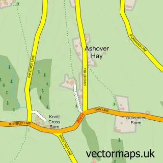
This Wessington street map is a detailed vector street map covering a 750m x 750m area. Select a larger area to create and download your own vector street map of Wessington.
The 750-metre map sample for Wessington covers 230 mapped buildings and approximately 15.9 km of road detail, of which 14 named roads are named. The immediate area includes 1 school, 1 pub and 1 MOT station. The wider area around Wessington features 1 food and drink venue. To create a larger or custom map of Wessington, the map builder lets you define your own coverage area and download editable SVG, PDF and PNG files.
Create a larger editable map of Wessington
Choose any area you need and generate a high-quality vector map instantly. Perfect for print, planning, design, business and personal use.

This Wessington street map in Derbyshire is available as downloadable SVG, PDF and PNG map files, or as a printed map for planning, business, display, education, local information and design work. You can also create a larger custom map area using the map selector.
What this Wessington map sample shows
Wessington lies within Wessington Cp parish, part of Shirland ward in the North East Derbyshire District local authority area. The postcode geography for this area includes the DE postcode area, the DE55 postcode district and the DE55 6 postcode sector. Residents fall under the Nhs Derby And Derbyshire Integrated Care Board for NHS services.
Local features near Wessington
Within 2 milesAmenities and services in and around Wessington.
Administrative and postcode information for Wessington
The local authority covering Wessington is North East Derbyshire District, within the county of Derbyshire. The settlement lies within Shirland ward and Wessington Cp civil parish. The DE55 postcode district and DE55 6 postcode sector serve the immediate area. NHS provision in the area is delivered through Chesterfield Royal Hospital Nhs Foundation Trust.
Nearby street map samples around Wessington

More street maps in Derbyshire
750 metre map area coverage
Boundary, postcode and point of interest information for the 750m x 750m rectangle centred on this sample map.
Boundaries containing map centre
Constituency: Bolsover Co Const
County: Derbyshire County
District: North East Derbyshire District
Icb: NHS Derby and Derbyshire ICB
Parish: Wessington CP
Police Force: derbyshire
Postcode District: DE55
Postcode Sector: DE55 6
Ward: Shirland Ward
Nearby boundaries intersecting sample
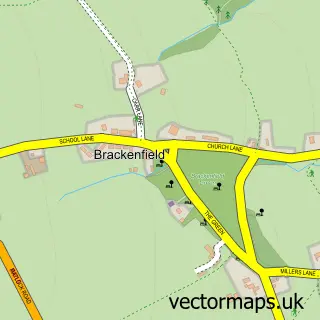
Parish: Brackenfield CP
Postcode coverage
POI category counts
Anglican Church: 1
Animal Shelter: 1
Automotive Repair: 1
Driving School: 1
Elementary School: 1
Engineering Services: 1
Fish And Chips Restaurant: 1
Gardener: 1
Professional Services: 1
Pub: 1
Sample points of interest
- Christ Church, Wessington
- Stankirk Boarding Kennels & Cattery
- S J Autos
- Helen Bannister Driver Training
- Wessington Primary School
- Wild Welding & Metal finishing
- Wessington's Fish and Chips
- David Lee Home & Garden Maintenance
- Chris Smith Photography
- Horse & Jockey
- River Cruise Tours
- Proctor Car Sales
Create a larger editable map of Wessington
This sample shows only a 750 metre area. To create a larger map of Wessington, use our map builder to choose your own coverage area, add titles and download editable SVG, PDF and PNG files.
Create a custom map of Wessington