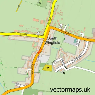
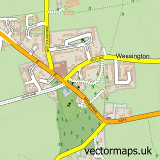
This Oakerthorpe street map is a detailed vector street map covering a 750m x 750m area. Select a larger area to create and download your own vector street map of Oakerthorpe.
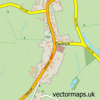
The 750-metre map sample for Oakerthorpe covers 78 mapped buildings and approximately 8.2 km of road detail, of which 4 named roads are named. The immediate area includes 2 GP surgeries within 2 miles, 2 pubs and 6 MOT stations within 2 miles. The wider area around Oakerthorpe features 1 tourism point of interest and 2 food and drink venues. To create a larger or custom map of Oakerthorpe, the map builder lets you define your own coverage area and download editable SVG, PDF and PNG files.
Create a larger editable map of Oakerthorpe
Choose any area you need and generate a high-quality vector map instantly. Perfect for print, planning, design, business and personal use.

This Oakerthorpe street map in Derbyshire is available as downloadable SVG, PDF and PNG map files, or as a printed map for planning, business, display, education, local information and design work. You can also create a larger custom map area using the map selector.
What this Oakerthorpe map sample shows
Oakerthorpe lies within South Wingfield Cp parish, part of Wingfield ward in the Amber Valley District (B) local authority area. The postcode geography for this area includes the DE postcode area, the DE55 postcode district and the DE55 7 postcode sector. Residents fall under the Nhs Derby And Derbyshire Integrated Care Board for NHS services.
Local features near Oakerthorpe
Within 2 milesAmenities and services in and around Oakerthorpe.
Administrative and postcode information for Oakerthorpe
The local authority covering Oakerthorpe is Amber Valley District (B), within the county of Derbyshire. The settlement lies within Wingfield ward and South Wingfield Cp civil parish. The DE55 postcode district and DE55 7 postcode sector serve the immediate area. NHS provision in the area is delivered through University Hospitals Of Derby And Burton Nhs Foundation Trust.
Nearby street map samples around Oakerthorpe

More street maps in Derbyshire
750 metre map area coverage
Boundary, postcode and point of interest information for the 750m x 750m rectangle centred on this sample map.
Boundaries containing map centre
Constituency: Amber Valley Co Const
County: Derbyshire County
District: Amber Valley District (B)
Icb: NHS Derby and Derbyshire ICB
Parish: South Wingfield CP
Police Force: derbyshire
Postcode District: DE55
Postcode Sector: DE55 7
Ward: Crich & South Wingfield Ward
Nearby boundaries intersecting sample
No additional intersecting boundaries found.
Postcode coverage
POI category counts
Pub: 2
Assisted Living Facility: 1
Bar: 1
Campground: 1
Golf Equipment: 1
Italian Restaurant: 1
Sample points of interest
- Hollybank House
- Pesto At The Peacock
- Woodside Grove Camping and Caravans
- Alfreton Pro Shop
- Pesto Restaurants
- Peacock Hotel
- The Butchers Arms
Create a larger editable map of Oakerthorpe
This sample shows only a 750 metre area. To create a larger map of Oakerthorpe, use our map builder to choose your own coverage area, add titles and download editable SVG, PDF and PNG files.
Create a custom map of Oakerthorpe