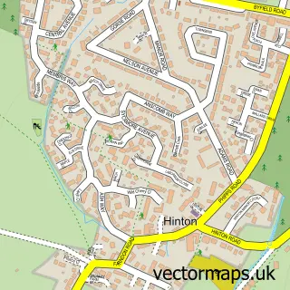
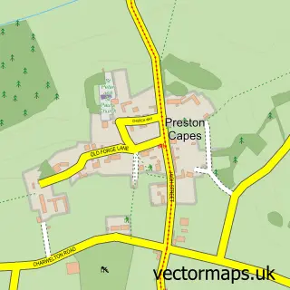
This Woodford Halse street map is a detailed vector street map covering a 750m x 750m area. Select a larger area to create and download your own vector street map of Woodford Halse.
The 750-metre map sample for Woodford Halse covers 204 mapped buildings and approximately 18.6 km of road detail, of which 22 named roads are named. The immediate area includes 1 school, 1 GP surgery within 2 miles, 1 pub and 1 MOT station. The wider area around Woodford Halse features 4 food and drink venues. To create a larger or custom map of Woodford Halse, the map builder lets you define your own coverage area and download editable SVG, PDF and PNG files.
Create a larger editable map of Woodford Halse
Choose any area you need and generate a high-quality vector map instantly. Perfect for print, planning, design, business and personal use.

This Woodford Halse street map in Northamptonshire is available as downloadable SVG, PDF and PNG map files, or as a printed map for planning, business, display, education, local information and design work. You can also create a larger custom map area using the map selector.
What this Woodford Halse map sample shows
Woodford Halse lies within Woodford Cum Membris Cp parish, part of Woodford ward in the West Northamptonshire local authority area. The postcode geography for this area includes the NN postcode area, the NN11 postcode district and the NN11 3 postcode sector. Residents fall under the Nhs Northamptonshire Integrated Care Board for NHS services.
Local features near Woodford Halse
Within 2 milesAmenities and services in and around Woodford Halse.
Administrative and postcode information for Woodford Halse
The local authority covering Woodford Halse is West Northamptonshire, within the county of Northamptonshire. The settlement lies within Woodford ward and Woodford Cum Membris Cp civil parish. The NN11 postcode district and NN11 3 postcode sector serve the immediate area. NHS provision in the area is delivered through Oxford University Hospitals Nhs Foundation Trust.
Nearby street map samples around Woodford Halse


More street maps in Northamptonshire
750 metre map area coverage
Boundary, postcode and point of interest information for the 750m x 750m rectangle centred on this sample map.
Boundaries containing map centre
Constituency: Daventry Co Const
District: West Northamptonshire
Icb: NHS Northamptonshire ICB
Parish: Woodford cum Membris CP
Police Force: northamptonshire
Postcode District: NN11
Postcode Sector: NN11 3
Ward: Woodford & Weedon Ward
Nearby boundaries intersecting sample
No additional intersecting boundaries found.
Postcode coverage
POI category counts
Post Office: 4
Retail: 3
Auction House: 2
Automotive Repair: 2
Barber: 2
Beauty Salon: 2
Flowers And Gifts Shop: 2
Garbage Collection Service: 2
Hair Salon: 2
Indian Restaurant: 2
Sample points of interest
- DLB Accountancy Services
- St Mary's Church, Woodford Halse
- Woodford Railwayana
- Renee Kern
- Great Central Railwayana Auctions
- Sheffield Railwayana Auctions
- Crystal Detailing
- Ultimate Windscreens
- Smith Automotive
- Central Way Garage
- ELS Automotive
- JET'S Barber Shop
Create a larger editable map of Woodford Halse
This sample shows only a 750 metre area. To create a larger map of Woodford Halse, use our map builder to choose your own coverage area, add titles and download editable SVG, PDF and PNG files.
Create a custom map of Woodford Halse