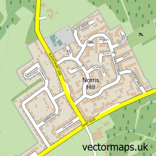
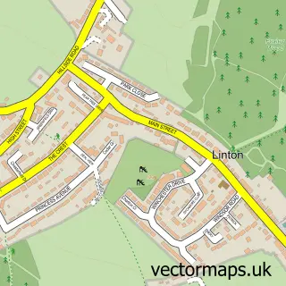
This Albert Village street map is a detailed vector street map covering a 750m x 750m area. Select a larger area to create and download your own vector street map of Albert Village.
The 750-metre map sample for Albert Village covers 167 mapped buildings and approximately 11.9 km of road detail, of which 16 named roads are named. The immediate area includes 1 school, 5 GP surgeries within 2 miles, 1 pub and 1 MOT station, with 15 within 2 miles. The wider area around Albert Village features 1 food and drink venue and 1 campsite within 2 miles. To create a larger or custom map of Albert Village, the map builder lets you define your own coverage area and download editable SVG, PDF and PNG files.
Create a larger editable map of Albert Village
Choose any area you need and generate a high-quality vector map instantly. Perfect for print, planning, design, business and personal use.

This Albert Village street map in Leicestershire is available as downloadable SVG, PDF and PNG map files, or as a printed map for planning, business, display, education, local information and design work. You can also create a larger custom map area using the map selector.
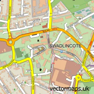
What this Albert Village map sample shows
Albert Village lies within Derbyshire County parish, part of Swadlincote ward in the South Derbyshire District local authority area. The postcode geography for this area includes the DE postcode area, the DE11 postcode district and the DE11 8 postcode sector. Residents fall under the Nhs Derby And Derbyshire Integrated Care Board for NHS services.
Local features near Albert Village
Within 2 milesAmenities and services in and around Albert Village.
Administrative and postcode information for Albert Village
The local authority covering Albert Village is South Derbyshire District, within the county of Leicestershire. The settlement lies within Swadlincote ward and Derbyshire County civil parish. The DE11 postcode district and DE11 8 postcode sector serve the immediate area. NHS provision in the area is delivered through University Hospitals Of Derby And Burton Nhs Foundation Trust.
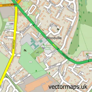
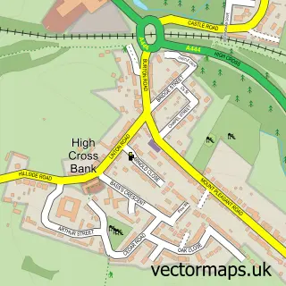
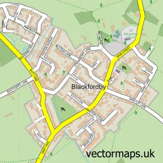
Nearby street map samples around Albert Village

More street maps in Leicestershire
750 metre map area coverage
Boundary, postcode and point of interest information for the 750m x 750m rectangle centred on this sample map.
Boundaries containing map centre
Constituency: North West Leicestershire Co Const
County: Leicestershire County
District: North West Leicestershire District
Icb: NHS Leicester Leicestershire and Rutland ICB
Parish: Ashby Woulds CP
Police Force: leicestershire
Postcode District: DE11
Postcode Sector: DE11 8
Ward: Ashby Woulds Ward
Nearby boundaries intersecting sample
Constituency: South Derbyshire Co Const
County: Derbyshire County
District: South Derbyshire District
Icb: NHS Derby and Derbyshire ICB
Parish: Woodville CP
Police Force: derbyshire
Postcode Sector: DE11 9
Ward: Church Gresley Ward, Woodville Ward
Postcode coverage
POI category counts
Building Supply Store: 1
Burger Restaurant: 1
Business Equipment And Supply: 1
Car Dealer: 1
Driving School: 1
Eatertainment: 1
Elementary School: 1
Fitness Trainer: 1
Freight And Cargo Service: 1
Metal Supplier: 1
Sample points of interest
- Tarmac Swadlincote Concrete Plant
- Maggie's Munchies
- Montracon Used Trailers
- Fearns Garage
- Progress School of Motoring
- CSI Parties
- Albert Village Community Primary School
- Fit 4 Life Personal Training
- Smiths logistics ltd
- Robin Hood Metals Ltd
- Paul Ace Music
- A Yap Me Dog
Create a larger editable map of Albert Village
This sample shows only a 750 metre area. To create a larger map of Albert Village, use our map builder to choose your own coverage area, add titles and download editable SVG, PDF and PNG files.
Create a custom map of Albert Village