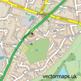
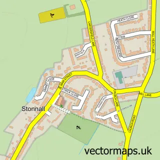
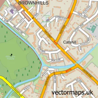
This Aldridge street map is a detailed vector street map covering a 750m x 750m area. Select a larger area to create and download your own vector street map of Aldridge.
The 750-metre map sample for Aldridge covers 255 mapped buildings and approximately 28.8 km of road detail, of which 38 named roads are named. The immediate area includes 2 GP surgeries, with 6 within 2 miles, 8 pubs and 12 MOT stations within 2 miles. The wider area around Aldridge features 2 tourism points of interest and 18 food and drink venues. To create a larger or custom map of Aldridge, the map builder lets you define your own coverage area and download editable SVG, PDF and PNG files.
Create a larger editable map of Aldridge
Choose any area you need and generate a high-quality vector map instantly. Perfect for print, planning, design, business and personal use.

This Aldridge street map in West Midlands is available as downloadable SVG, PDF and PNG map files, or as a printed map for planning, business, display, education, local information and design work. You can also create a larger custom map area using the map selector.
What this Aldridge map sample shows
Aldridge lies within Walsall District (B) parish, part of Aldridge Central And South ward in the Walsall District (B) local authority area. The postcode geography for this area includes the WS postcode area, the WS9 postcode district and the WS9 0 postcode sector. Residents fall under the Nhs Black Country Integrated Care Board for NHS services.
Local features near Aldridge
Within 2 milesAmenities and services in and around Aldridge.
Administrative and postcode information for Aldridge
Aldridge lies within Walsall District (B) parish, part of Aldridge Central And South ward in the Walsall District (B) local authority area. The postcode geography for this area includes the WS postcode area, the WS9 postcode district and the WS9 0 postcode sector. Residents fall under the Nhs Black Country Integrated Care Board for NHS services.
Nearby street map samples around Aldridge


More street maps in West Midlands
750 metre map area coverage
Boundary, postcode and point of interest information for the 750m x 750m rectangle centred on this sample map.
Boundaries containing map centre
Constituency: Aldridge-Brownhills Boro Const
District: Walsall District (B)
Icb: NHS Black Country ICB
Police Force: west midlands
Postcode District: WS9
Postcode Sector: WS9 8
Ward: Aldridge Central and South Ward
Nearby boundaries intersecting sample
Postcode Sector: WS9 0
Postcode coverage
POI category counts
Beauty Salon: 14
Hair Salon: 13
Indian Restaurant: 12
Pub: 8
Contractor: 6
Eyewear And Optician: 6
Travel Agents: 6
Gym: 5
Pharmacy: 5
Restaurant: 5
Sample points of interest
- Aldridge Manor House
- Bickerstaff & Co.
- Edwards Chartered Accountants
- TaxAssist Accountants
- J7 Sports & Trophies
- Sports Plus Scheme Ltd
- Afrikana Walsall
- Lucky Strike
- Sense
- M & I
- Marine Aquatics
- Marine Aquatics
Create a larger editable map of Aldridge
This sample shows only a 750 metre area. To create a larger map of Aldridge, use our map builder to choose your own coverage area, add titles and download editable SVG, PDF and PNG files.
Create a custom map of Aldridge