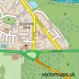
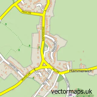
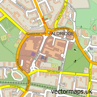
This Brownhills street map is a detailed vector street map covering a 750m x 750m area. Select a larger area to create and download your own vector street map of Brownhills.
The 750-metre map sample for Brownhills covers 374 mapped buildings and approximately 23.2 km of road detail, of which 31 named roads are named. The immediate area includes 1 school, 7 GP surgeries within 2 miles and 12 MOT stations within 2 miles. The wider area around Brownhills features 2 tourism points of interest and 3 food and drink venues. To create a larger or custom map of Brownhills, the map builder lets you define your own coverage area and download editable SVG, PDF and PNG files.
Create a larger editable map of Brownhills
Choose any area you need and generate a high-quality vector map instantly. Perfect for print, planning, design, business and personal use.

This Brownhills street map in West Midlands is available as downloadable SVG, PDF and PNG map files, or as a printed map for planning, business, display, education, local information and design work. You can also create a larger custom map area using the map selector.
What this Brownhills map sample shows
Brownhills lies within Walsall District (B) parish, part of Brownhills ward in the Walsall District (B) local authority area. The postcode geography for this area includes the WS postcode area, the WS8 postcode district and the WS8 6 postcode sector. Residents fall under the Nhs Black Country Integrated Care Board for NHS services.
Local features near Brownhills
Within 2 milesAmenities and services in and around Brownhills.
Administrative and postcode information for Brownhills
Brownhills lies within Walsall District (B) parish, part of Brownhills ward in the Walsall District (B) local authority area. The postcode geography for this area includes the WS postcode area, the WS8 postcode district and the WS8 6 postcode sector. Residents fall under the Nhs Black Country Integrated Care Board for NHS services.
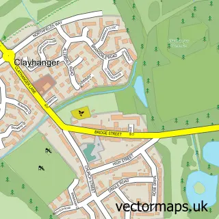
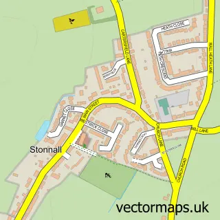
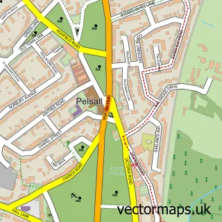
Nearby street map samples around Brownhills


More street maps in West Midlands
750 metre map area coverage
Boundary, postcode and point of interest information for the 750m x 750m rectangle centred on this sample map.
Boundaries containing map centre
Constituency: Aldridge-Brownhills Boro Const
District: Walsall District (B)
Icb: NHS Black Country ICB
Police Force: west midlands
Postcode District: WS8
Postcode Sector: WS8 6
Ward: Brownhills Ward
Nearby boundaries intersecting sample
Postcode Sector: WS8 7
Ward: Aldridge North and Walsall Wood Ward
Postcode coverage
POI category counts
Beauty Salon: 6
Professional Services: 4
Audiovisual Equipment Rental: 2
Automotive Repair: 2
Bakery: 2
Building Supply Store: 2
Church Cathedral: 2
Dentist: 2
Driving School: 2
Elementary School: 2
Sample points of interest
- Knaves Court Housing 21
- Payzone
- Access Repairs Ltd.
- Speedy Services
- Cannock Bumpers & Plastics
- Motolek Ltd
- Pit Stop Motors
- Anchor Garage
- Cheers Madeira
- Fairy Good Cakes
- Classic Cuts
- Envy The Hair & Beauty Salon
Create a larger editable map of Brownhills
This sample shows only a 750 metre area. To create a larger map of Brownhills, use our map builder to choose your own coverage area, add titles and download editable SVG, PDF and PNG files.
Create a custom map of Brownhills