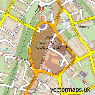
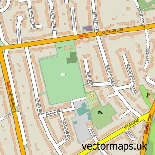
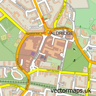
This Four Oaks street map is a detailed vector street map covering a 750m x 750m area. Select a larger area to create and download your own vector street map of Four Oaks.
The 750-metre map sample for Four Oaks covers 371 mapped buildings and approximately 28.4 km of road detail, of which 28 named roads are named. The immediate area includes 1 school, 2 GP surgeries within 2 miles, 5 pubs and 7 MOT stations within 2 miles. The wider area around Four Oaks features 3 tourism points of interest and 6 food and drink venues. To create a larger or custom map of Four Oaks, the map builder lets you define your own coverage area and download editable SVG, PDF and PNG files.
Create a larger editable map of Four Oaks
Choose any area you need and generate a high-quality vector map instantly. Perfect for print, planning, design, business and personal use.

This Four Oaks street map in West Midlands is available as downloadable SVG, PDF and PNG map files, or as a printed map for planning, business, display, education, local information and design work. You can also create a larger custom map area using the map selector.
What this Four Oaks map sample shows
Four Oaks lies within Sutton Coldfield Cp parish, part of Sutton Mere Green ward in the Birmingham District (B) local authority area. The postcode geography for this area includes the B postcode area, the B75 postcode district and the B75 5 postcode sector. Residents fall under the Nhs Birmingham And Solihull Integrated Care Board for NHS services.
Local features near Four Oaks
Within 2 milesAmenities and services in and around Four Oaks.
Administrative and postcode information for Four Oaks
The local authority covering Four Oaks is Birmingham District (B), within the county of West Midlands. The settlement lies within Sutton Mere Green ward and Sutton Coldfield Cp civil parish. The B75 postcode district and B75 5 postcode sector serve the immediate area. NHS provision in the area is delivered through University Hospitals Birmingham Nhs Foundation Trust.
Nearby street map samples around Four Oaks


More street maps in West Midlands
750 metre map area coverage
Boundary, postcode and point of interest information for the 750m x 750m rectangle centred on this sample map.
Boundaries containing map centre
Constituency: Sutton Coldfield Boro Const
District: Birmingham District (B)
Icb: NHS Birmingham and Solihull ICB
Parish: Sutton Coldfield CP
Police Force: west midlands
Postcode District: B74
Postcode Sector: B74 4
Ward: Sutton Four Oaks Ward
Nearby boundaries intersecting sample
Postcode District: B75
Postcode Sector: B74 2, B75 5
Ward: Sutton Mere Green Ward
Postcode coverage
POI category counts
Hair Salon: 7
Pub: 5
Building Contractor: 3
Building Supply Store: 3
Church Cathedral: 3
Financial Advising: 3
Martial Arts Club: 3
Post Office: 3
Anglican Church: 2
Beauty Salon: 2
Sample points of interest
- Herbs of China
- All Saints C of E Church
- All Saints Four Oaks
- Sitting Knitting
- Timpson
- Lloyds Bank
- Body and Sole
- Lashy Lifestyle
- William Hill
- Glammed Up
- Francis Builder
- Francis Builders
Create a larger editable map of Four Oaks
This sample shows only a 750 metre area. To create a larger map of Four Oaks, use our map builder to choose your own coverage area, add titles and download editable SVG, PDF and PNG files.
Create a custom map of Four Oaks