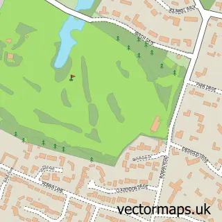
This Shenstone street map is a detailed vector street map covering a 750m x 750m area. Select a larger area to create and download your own vector street map of Shenstone.
The 750-metre map sample for Shenstone covers 390 mapped buildings and approximately 25.3 km of road detail, of which 28 named roads are named. The immediate area includes 1 school, 1 railway station, 6 pubs and 1 MOT station within 2 miles. The wider area around Shenstone features 1 tourism point of interest and 10 food and drink venues. To create a larger or custom map of Shenstone, the map builder lets you define your own coverage area and download editable SVG, PDF and PNG files.
Create a larger editable map of Shenstone
Choose any area you need and generate a high-quality vector map instantly. Perfect for print, planning, design, business and personal use.

This Shenstone street map in Staffordshire is available as downloadable SVG, PDF and PNG map files, or as a printed map for planning, business, display, education, local information and design work. You can also create a larger custom map area using the map selector.
What this Shenstone map sample shows
Shenstone lies within Shenstone Cp parish, part of Shenstone ward in the Lichfield District local authority area. The postcode geography for this area includes the WS postcode area, the WS14 postcode district and the WS14 0 postcode sector. Residents fall under the Nhs Staffordshire And Stoke-On-Trent Integrated Care Board for NHS services.
Local features near Shenstone
Within 2 milesAmenities and services in and around Shenstone.
Administrative and postcode information for Shenstone
Shenstone lies within Shenstone Cp parish, part of Shenstone ward in the Lichfield District local authority area. The postcode geography for this area includes the WS postcode area, the WS14 postcode district and the WS14 0 postcode sector. Residents fall under the Nhs Staffordshire And Stoke-On-Trent Integrated Care Board for NHS services.
Nearby street map samples around Shenstone


More street maps in Staffordshire
750 metre map area coverage
Boundary, postcode and point of interest information for the 750m x 750m rectangle centred on this sample map.
Boundaries containing map centre
Constituency: Tamworth Co Const
County: Staffordshire County
District: Lichfield District
Icb: NHS Black Country ICB
Parish: Shenstone CP
Police Force: staffordshire
Postcode District: WS14
Postcode Sector: WS14 0
Ward: Shenstone Ward
Nearby boundaries intersecting sample
No additional intersecting boundaries found.
Postcode coverage
POI category counts
Pub: 6
Library: 3
Restaurant: 3
Accountant: 2
Advertising Agency: 2
Church Cathedral: 2
Community Center: 2
Convenience Store: 2
Courier And Delivery Services: 2
Doctor: 2
Sample points of interest
- Aims Accountants for Business
- Lindley & Co
- Omex Document Solutions
- Two Thirds Design
- Kelly Chamberlain Psychic Medium
- Shenstone Tennis Club
- James Cook Building Services
- Shenstone Hall Nursing Home
- Chocolat International
- Shenstone Country Club
- Serenity Beauty
- Bingo Compare - Online Bingo Site Comparison
Create a larger editable map of Shenstone
This sample shows only a 750 metre area. To create a larger map of Shenstone, use our map builder to choose your own coverage area, add titles and download editable SVG, PDF and PNG files.
Create a custom map of Shenstone