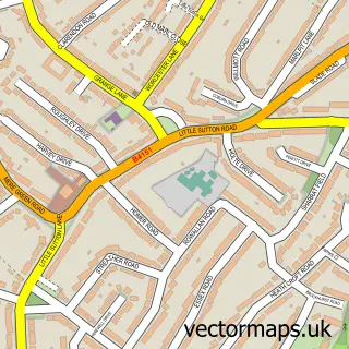
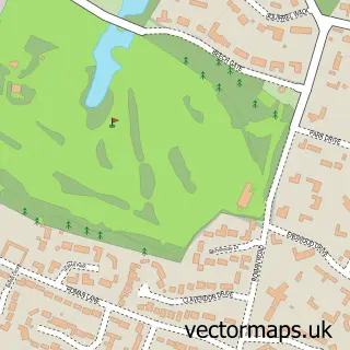
This Sutton Coldfield street map is a detailed vector street map covering a 750m x 750m area. Select a larger area to create and download your own vector street map of Sutton Coldfield.
The 750-metre map sample for Sutton Coldfield covers 289 mapped buildings and approximately 38.6 km of road detail, of which 42 named roads are named. The immediate area includes 1 railway station, 5 GP surgeries within 2 miles, 11 pubs and 1 MOT station, with 11 within 2 miles. The wider area around Sutton Coldfield features 3 tourism points of interest, 26 food and drink venues and 1 hotel. To create a larger or custom map of Sutton Coldfield, the map builder lets you define your own coverage area and download editable SVG, PDF and PNG files.
Create a larger editable map of Sutton Coldfield
Choose any area you need and generate a high-quality vector map instantly. Perfect for print, planning, design, business and personal use.

This Sutton Coldfield street map in West Midlands is available as downloadable SVG, PDF and PNG map files, or as a printed map for planning, business, display, education, local information and design work. You can also create a larger custom map area using the map selector.
What this Sutton Coldfield map sample shows
Sutton Coldfield lies within Sutton Coldfield Cp parish, part of Sutton Trinity ward in the Birmingham District (B) local authority area. The postcode geography for this area includes the B postcode area, the B72 postcode district and the B72 1 postcode sector. Residents fall under the Nhs Birmingham And Solihull Integrated Care Board for NHS services.
Local features near Sutton Coldfield
Within 2 milesAmenities and services in and around Sutton Coldfield.
Administrative and postcode information for Sutton Coldfield
The local authority covering Sutton Coldfield is Birmingham District (B), within the county of West Midlands. The settlement lies within Sutton Trinity ward and Sutton Coldfield Cp civil parish. The B72 postcode district and B72 1 postcode sector serve the immediate area. NHS provision in the area is delivered through University Hospitals Birmingham Nhs Foundation Trust.
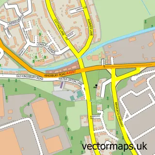
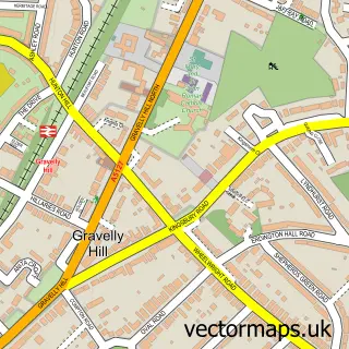
Nearby street map samples around Sutton Coldfield


More street maps in West Midlands
750 metre map area coverage
Boundary, postcode and point of interest information for the 750m x 750m rectangle centred on this sample map.
Boundaries containing map centre
Constituency: Sutton Coldfield Boro Const
District: Birmingham District (B)
Icb: NHS Birmingham and Solihull ICB
Parish: Sutton Coldfield CP
Police Force: west midlands
Postcode District: B72
Postcode Sector: B72 1
Ward: Sutton Trinity Ward
Nearby boundaries intersecting sample
Postcode District: B73, B75
Postcode Sector: B73 6, B75 7
Postcode coverage
POI category counts
Clothing Store: 19
Professional Services: 19
Bank Credit Union: 14
Employment Agencies: 14
Financial Service: 12
Jewelry Store: 12
Advertising Agency: 11
Pub: 11
Mobile Phone Store: 10
Shopping Center: 10
Sample points of interest
- Harwoods
- S J D Accountancy
- Future 11
- Acupuncture Centre
- Sutton Adult Learning Centre
- Adventure Graphics
- Apex Outdoor Advertising
- Cashillion Uk Ltd.
- Chosen Communications
- Digital Arts
- Impact Outdoor Advertising / Media
- Impact Outdoor Advertising Ltd.
Create a larger editable map of Sutton Coldfield
This sample shows only a 750 metre area. To create a larger map of Sutton Coldfield, use our map builder to choose your own coverage area, add titles and download editable SVG, PDF and PNG files.
Create a custom map of Sutton Coldfield