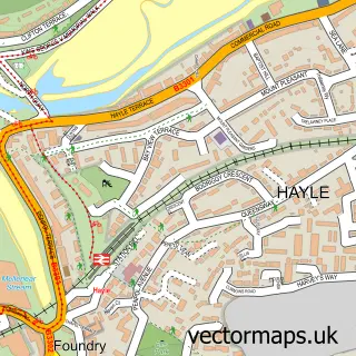
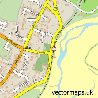
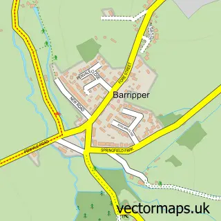
This Angarrack street map is a detailed vector street map covering a 750m x 750m area. Select a larger area to create and download your own vector street map of Angarrack.
The 750-metre map sample for Angarrack covers 156 mapped buildings and approximately 9.3 km of road detail, of which 12 named roads are named. The immediate area includes 1 GP surgery within 2 miles, 1 pub and 1 MOT station, with 5 within 2 miles. The wider area around Angarrack features 1 food and drink venue, 4 hotels and 10 campsites within 2 miles. To create a larger or custom map of Angarrack, the map builder lets you define your own coverage area and download editable SVG, PDF and PNG files.
Create a larger editable map of Angarrack
Choose any area you need and generate a high-quality vector map instantly. Perfect for print, planning, design, business and personal use.

This Angarrack street map in Cornwall is available as downloadable SVG, PDF and PNG map files, or as a printed map for planning, business, display, education, local information and design work. You can also create a larger custom map area using the map selector.
What this Angarrack map sample shows
Angarrack lies within Hayle Cp parish, part of Hayle South ward in the Cornwall local authority area. The postcode geography for this area includes the TR postcode area, the TR27 postcode district and the TR27 5 postcode sector. Residents fall under the Nhs Cornwall And The Isles Of Scilly Integrated Care Board for NHS services.
Local features near Angarrack
Within 2 milesAmenities and services in and around Angarrack.
Administrative and postcode information for Angarrack
The local authority covering Angarrack is Cornwall, within the county of Cornwall. The settlement lies within Hayle South ward and Hayle Cp civil parish. The TR27 postcode district and TR27 5 postcode sector serve the immediate area. NHS provision in the area is delivered through Royal Cornwall Hospitals Nhs Trust.
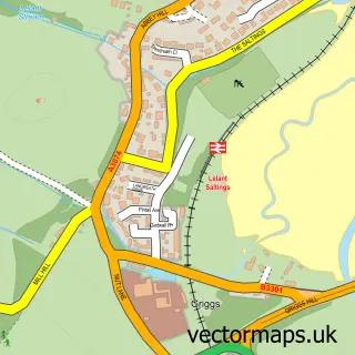
Nearby street map samples around Angarrack

More street maps in Cornwall
750 metre map area coverage
Boundary, postcode and point of interest information for the 750m x 750m rectangle centred on this sample map.
Boundaries containing map centre
Constituency: Camborne and Redruth Co Const
District: Cornwall
Icb: NHS Cornwall and the Isles of Scilly ICB
Parish: Hayle CP
Police Force: devon and cornwall
Postcode District: TR27
Postcode Sector: TR27 5
Nearby boundaries intersecting sample
No additional intersecting boundaries found.
Postcode coverage
POI category counts
Hotel: 4
Automotive: 2
Automotive Repair: 1
Barber: 1
Building Supply Store: 1
Bus Service: 1
Business: 1
Car Wash: 1
Clothing Store: 1
Commercial Industrial: 1
Sample points of interest
- Hawkins Kia Hayle
- Nissen Hut
- Hayle Garage Services
- Unit 24 Barbershop
- Cornwall Building Supplies
- Hayle Taxis
- Penna
- DJW Hayle Car Valeting
- Exhibit 1
- Marsh Lane Industrial Estate
- Cornwall Stairs Limited
- Butterflies Montessori Nursery
Create a larger editable map of Angarrack
This sample shows only a 750 metre area. To create a larger map of Angarrack, use our map builder to choose your own coverage area, add titles and download editable SVG, PDF and PNG files.
Create a custom map of Angarrack