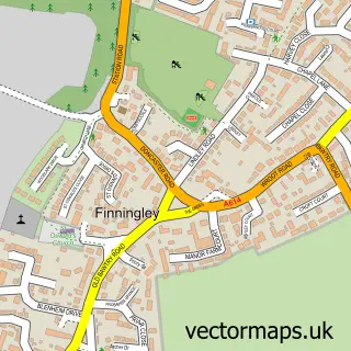
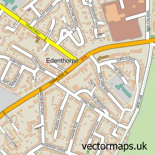
This Auckley street map is a detailed vector street map covering a 750m x 750m area. Select a larger area to create and download your own vector street map of Auckley.
The 750-metre map sample for Auckley covers 453 mapped buildings and approximately 18.2 km of road detail, of which 26 named roads are named. The immediate area includes 1 school, 1 pub and 1 MOT station, with 2 within 2 miles. The wider area around Auckley features 2 food and drink venues. To create a larger or custom map of Auckley, the map builder lets you define your own coverage area and download editable SVG, PDF and PNG files.
Create a larger editable map of Auckley
Choose any area you need and generate a high-quality vector map instantly. Perfect for print, planning, design, business and personal use.

This Auckley street map in South Yorkshire is available as downloadable SVG, PDF and PNG map files, or as a printed map for planning, business, display, education, local information and design work. You can also create a larger custom map area using the map selector.
What this Auckley map sample shows
Auckley lies within Auckley Cp parish, part of Finningley ward in the Doncaster District (B) local authority area. The postcode geography for this area includes the DN postcode area, the DN9 postcode district and the DN9 3 postcode sector. Residents fall under the Nhs South Yorkshire Integrated Care Board for NHS services.
Local features near Auckley
Within 2 milesAmenities and services in and around Auckley.
Administrative and postcode information for Auckley
Auckley lies within Auckley Cp parish, part of Finningley ward in the Doncaster District (B) local authority area. The postcode geography for this area includes the DN postcode area, the DN9 postcode district and the DN9 3 postcode sector. Residents fall under the Nhs South Yorkshire Integrated Care Board for NHS services.
Nearby street map samples around Auckley

More street maps in South Yorkshire
750 metre map area coverage
Boundary, postcode and point of interest information for the 750m x 750m rectangle centred on this sample map.
Boundaries containing map centre
Constituency: Doncaster East and the Isle of Axholme Co Const
District: Doncaster District (B)
Icb: NHS South Yorkshire ICB
Parish: Auckley CP
Police Force: south yorkshire
Postcode District: DN9
Postcode Sector: DN9 3
Ward: Finningley Ward
Nearby boundaries intersecting sample
Parish: Cantley CP
Postcode coverage
POI category counts
Church Cathedral: 2
Community Services Non Profits: 2
Post Office: 2
Anglican Church: 1
Atms: 1
Bridal Shop: 1
Building Supply Store: 1
Chinese Restaurant: 1
Coffee Shop: 1
Convenience Store: 1
Sample points of interest
- St Saviour's Church
- BR Spar Auckley, Auckley
- Doncaster Wheatsheaf Singers
- Hanson Aggregates
- Oriental Chinese
- Auckley Methodist Church
- Auckley Parish Centre
- Costa Express
- Auckley Women's Institute
- British Association of Sport and Exercise Medicine - BASEM
- SPAR Auckley
- Hair Drying Solutions
Create a larger editable map of Auckley
This sample shows only a 750 metre area. To create a larger map of Auckley, use our map builder to choose your own coverage area, add titles and download editable SVG, PDF and PNG files.
Create a custom map of Auckley