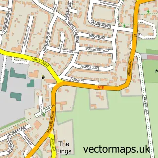
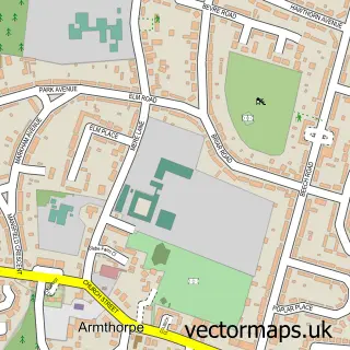
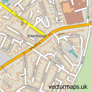
This Branton street map is a detailed vector street map covering a 750m x 750m area. Select a larger area to create and download your own vector street map of Branton.
The 750-metre map sample for Branton covers 500 mapped buildings and approximately 15.4 km of road detail, of which 30 named roads are named. The immediate area includes 1 school, 1 GP surgery within 2 miles, 2 pubs and 4 MOT stations within 2 miles. The wider area around Branton features 2 food and drink venues. To create a larger or custom map of Branton, the map builder lets you define your own coverage area and download editable SVG, PDF and PNG files.
Create a larger editable map of Branton
Choose any area you need and generate a high-quality vector map instantly. Perfect for print, planning, design, business and personal use.

This Branton street map in South Yorkshire is available as downloadable SVG, PDF and PNG map files, or as a printed map for planning, business, display, education, local information and design work. You can also create a larger custom map area using the map selector.
What this Branton map sample shows
Branton lies within Cantley Cp parish, part of Finningley ward in the Doncaster District (B) local authority area. The postcode geography for this area includes the DN postcode area, the DN3 postcode district and the DN3 3 postcode sector. Residents fall under the Nhs South Yorkshire Integrated Care Board for NHS services.
Local features near Branton
Within 2 milesAmenities and services in and around Branton.
Administrative and postcode information for Branton
The local authority covering Branton is Doncaster District (B), within the county of South Yorkshire. The settlement lies within Finningley ward and Cantley Cp civil parish. The DN3 postcode district and DN3 3 postcode sector serve the immediate area. NHS provision in the area is delivered through Doncaster And Bassetlaw Teaching Hospitals Nhs Foundation Trust.
Nearby street map samples around Branton

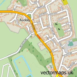
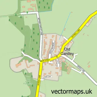
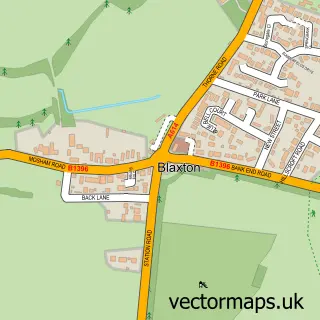
More street maps in South Yorkshire
750 metre map area coverage
Boundary, postcode and point of interest information for the 750m x 750m rectangle centred on this sample map.
Boundaries containing map centre
Constituency: Doncaster East and the Isle of Axholme Co Const
District: Doncaster District (B)
Icb: NHS South Yorkshire ICB
Parish: Cantley CP
Police Force: south yorkshire
Postcode District: DN3
Postcode Sector: DN3 3
Ward: Finningley Ward
Nearby boundaries intersecting sample
No additional intersecting boundaries found.
Postcode coverage
POI category counts
Beauty Salon: 4
Beauty And Spa: 2
Elementary School: 2
It Service And Computer Repair: 2
Pest Control Service: 2
Pub: 2
Building Supply Store: 1
Carpenter: 1
Community Center: 1
Computer Store: 1
Sample points of interest
- JLB Beauty, Aesthetics and Training
- KyBrows
- 2 Moor View
- Chloes Little Beauty Room
- Sarah Vernon -Independent educator & nail artist
- The English Work and Travel Agency Limited
- TC Decorating & Spraying Contractors Ltd
- South Yorkshire Damp Proof Specialists
- Kilham Hall, Branton
- TECCS Computer Repairs & IT Services
- AJH Electrical Services
- Branton St Wilfrid's Church of England Primary School
Create a larger editable map of Branton
This sample shows only a 750 metre area. To create a larger map of Branton, use our map builder to choose your own coverage area, add titles and download editable SVG, PDF and PNG files.
Create a custom map of Branton