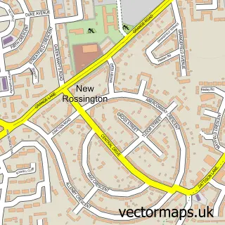
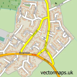
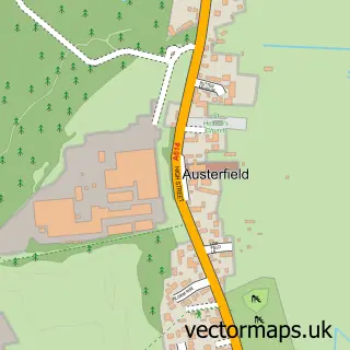
This Rossington street map is a detailed vector street map covering a 750m x 750m area. Select a larger area to create and download your own vector street map of Rossington.
The 750-metre map sample for Rossington covers 565 mapped buildings and approximately 26.1 km of road detail, of which 42 named roads are named. The immediate area includes 2 schools, 3 GP surgeries within 2 miles, 1 pub and 4 MOT stations within 2 miles. The wider area around Rossington features 3 food and drink venues. To create a larger or custom map of Rossington, the map builder lets you define your own coverage area and download editable SVG, PDF and PNG files.
Create a larger editable map of Rossington
Choose any area you need and generate a high-quality vector map instantly. Perfect for print, planning, design, business and personal use.

This Rossington street map in South Yorkshire is available as downloadable SVG, PDF and PNG map files, or as a printed map for planning, business, display, education, local information and design work. You can also create a larger custom map area using the map selector.
What this Rossington map sample shows
Rossington lies within Rossington Cp parish, part of Rossington & Bawtry ward in the Doncaster District (B) local authority area. The postcode geography for this area includes the DN postcode area, the DN11 postcode district and the DN11 0 postcode sector. Residents fall under the Nhs South Yorkshire Integrated Care Board for NHS services.
Local features near Rossington
Within 2 milesAmenities and services in and around Rossington.
Administrative and postcode information for Rossington
Rossington lies within Rossington Cp parish, part of Rossington & Bawtry ward in the Doncaster District (B) local authority area. The postcode geography for this area includes the DN postcode area, the DN11 postcode district and the DN11 0 postcode sector. Residents fall under the Nhs South Yorkshire Integrated Care Board for NHS services.
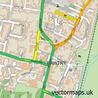
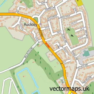
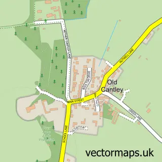
Nearby street map samples around Rossington

More street maps in South Yorkshire
750 metre map area coverage
Boundary, postcode and point of interest information for the 750m x 750m rectangle centred on this sample map.
Boundaries containing map centre
Constituency: Doncaster East and the Isle of Axholme Co Const
District: Doncaster District (B)
Icb: NHS South Yorkshire ICB
Parish: Rossington CP
Police Force: south yorkshire
Postcode District: DN11
Postcode Sector: DN11 0
Ward: Rossington & Bawtry Ward
Nearby boundaries intersecting sample
No additional intersecting boundaries found.
Postcode coverage
POI category counts
Building Supply Store: 4
Elementary School: 4
Bakery: 2
Beauty Salon: 2
Convenience Store: 2
Driving School: 2
Landscape Architect: 2
Police Department: 2
Professional Services: 2
Alternative Medicine: 1
Sample points of interest
- Calma Clients
- St Michael's Church Rossington
- Fourseasons Health Care
- Beeneys
- Rainbow Cakes
- Beauty By Donna
- Jo Carley Skin Specialist & Beauty
- Blue Butterfly Garden Maintenance & Design
- Doncaster PAT Testing Services
- Jd Landsapes
- Stonehand Electrical
- Doncaster Property Maintenance
Create a larger editable map of Rossington
This sample shows only a 750 metre area. To create a larger map of Rossington, use our map builder to choose your own coverage area, add titles and download editable SVG, PDF and PNG files.
Create a custom map of Rossington