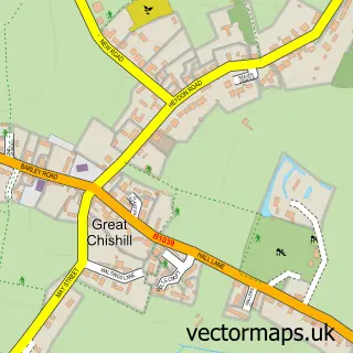
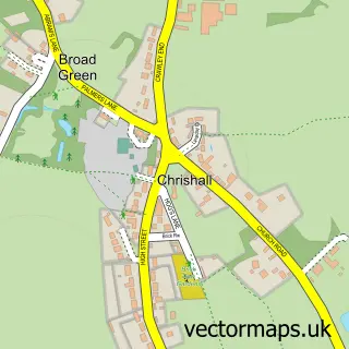
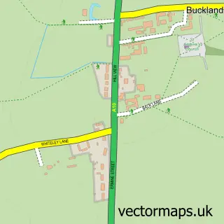
This Barley street map is a detailed vector street map covering a 750m x 750m area. Select a larger area to create and download your own vector street map of Barley.
The 750-metre map sample for Barley covers 220 mapped buildings and approximately 9.6 km of road detail, of which 16 named roads are named. The immediate area includes 1 school and 3 pubs. The wider area around Barley features 1 tourism point of interest and 3 food and drink venues. To create a larger or custom map of Barley, the map builder lets you define your own coverage area and download editable SVG, PDF and PNG files.
Create a larger editable map of Barley
Choose any area you need and generate a high-quality vector map instantly. Perfect for print, planning, design, business and personal use.

This Barley street map in Hertfordshire is available as downloadable SVG, PDF and PNG map files, or as a printed map for planning, business, display, education, local information and design work. You can also create a larger custom map area using the map selector.
What this Barley map sample shows
Barley lies within Barley Cp parish, part of Ermine ward in the North Hertfordshire District local authority area. The postcode geography for this area includes the SG postcode area, the SG8 postcode district and the SG8 8 postcode sector. Residents fall under the Nhs Cambridgeshire And Peterborough Integrated Care Board for NHS services.
Local features near Barley
Within 2 milesAmenities and services in and around Barley.
Administrative and postcode information for Barley
The local authority covering Barley is North Hertfordshire District, within the county of Hertfordshire. The settlement lies within Ermine ward and Barley Cp civil parish. The SG8 postcode district and SG8 8 postcode sector serve the immediate area. NHS provision in the area is delivered through East And North Hertfordshire Nhs Trust.
Nearby street map samples around Barley


More street maps in Hertfordshire
750 metre map area coverage
Boundary, postcode and point of interest information for the 750m x 750m rectangle centred on this sample map.
Boundaries containing map centre
Constituency: North East Hertfordshire Co Const
County: Hertfordshire County
District: North Hertfordshire District
Icb: NHS Central East ICB
Parish: Barley CP
Police Force: hertfordshire
Postcode District: SG8
Postcode Sector: SG8 8
Ward: Ermine Ward
Nearby boundaries intersecting sample
No additional intersecting boundaries found.
Postcode coverage
POI category counts
Advertising Agency: 3
Pub: 3
Doctor: 2
Irish Pub: 2
Scout Hall: 2
Auto Restoration Services: 1
Building Supply Store: 1
Church Cathedral: 1
Community Center: 1
Convenience Store: 1
Sample points of interest
- Bright
- Bright Advertising Ltd.
- The Design Studio
- John Foy Ltd.
- Quinlivan Plumbing & Heating
- St Margaret of Antioch
- Barley Town House
- Londis BARLEY STORES
- Granta Medical Practices, Barley Surgery
- The Barley Surgery
- Barley V C First School
- Pace
Create a larger editable map of Barley
This sample shows only a 750 metre area. To create a larger map of Barley, use our map builder to choose your own coverage area, add titles and download editable SVG, PDF and PNG files.
Create a custom map of Barley