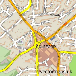
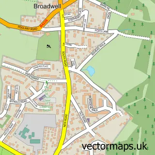
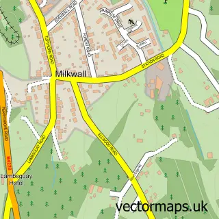
This Berry Hill street map is a detailed vector street map covering a 750m x 750m area. Select a larger area to create and download your own vector street map of Berry Hill.
The 750-metre map sample for Berry Hill covers 561 mapped buildings and approximately 53.3 km of road detail, of which 28 named roads are named. The immediate area includes 1 school, 1 GP surgery within 2 miles, 1 pub and 7 MOT stations within 2 miles. The wider area around Berry Hill features 1 tourism point of interest, 2 food and drink venues and 2 campsites within 2 miles. To create a larger or custom map of Berry Hill, the map builder lets you define your own coverage area and download editable SVG, PDF and PNG files.
Create a larger editable map of Berry Hill
Choose any area you need and generate a high-quality vector map instantly. Perfect for print, planning, design, business and personal use.

This Berry Hill street map in Gloucestershire is available as downloadable SVG, PDF and PNG map files, or as a printed map for planning, business, display, education, local information and design work. You can also create a larger custom map area using the map selector.
What this Berry Hill map sample shows
Berry Hill lies within Coleford Cp parish, part of Coleford ward in the Forest Of Dean District local authority area. The postcode geography for this area includes the GL postcode area, the GL16 postcode district and the GL16 8 postcode sector. Residents fall under the Nhs Gloucestershire Integrated Care Board for NHS services.
Local features near Berry Hill
Within 2 milesAmenities and services in and around Berry Hill.
Administrative and postcode information for Berry Hill
Berry Hill lies within Coleford Cp parish, part of Coleford ward in the Forest Of Dean District local authority area. The postcode geography for this area includes the GL postcode area, the GL16 postcode district and the GL16 8 postcode sector. Residents fall under the Nhs Gloucestershire Integrated Care Board for NHS services.
Nearby street map samples around Berry Hill

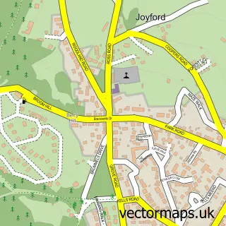
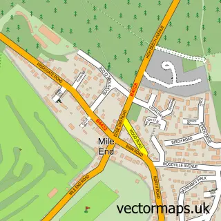
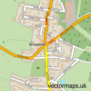
More street maps in Gloucestershire
750 metre map area coverage
Boundary, postcode and point of interest information for the 750m x 750m rectangle centred on this sample map.
Boundaries containing map centre
Constituency: Forest of Dean Co Const
County: Gloucestershire County
District: Forest of Dean District
Icb: NHS Gloucestershire ICB
Parish: West Dean CP
Police Force: gloucestershire
Postcode District: GL16
Postcode Sector: GL16 7
Ward: Berry Hill Ward
Nearby boundaries intersecting sample
Postcode Sector: GL16 8
Postcode coverage
POI category counts
Professional Services: 3
Shipping Center: 2
Accountant: 1
Automotive Repair: 1
Bar: 1
Bed And Breakfast: 1
Building Supply Store: 1
Cafe: 1
Charity Organization: 1
Contractor: 1
Sample points of interest
- Phb Accountancy Services Ltd.
- Engine Carbon Clean
- Berry Hill Social Club
- Berry Hill House
- Stephen D Cooper & Sons Ltd
- Pitchside cafe
- Berry Hill Memorial Institute - "The Hut"
- J W Reeves Builders
- Premier
- Post Office Travel Money
- Hillview Training Solutions
- Berry Hill Primary School
Create a larger editable map of Berry Hill
This sample shows only a 750 metre area. To create a larger map of Berry Hill, use our map builder to choose your own coverage area, add titles and download editable SVG, PDF and PNG files.
Create a custom map of Berry Hill