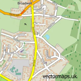
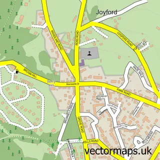
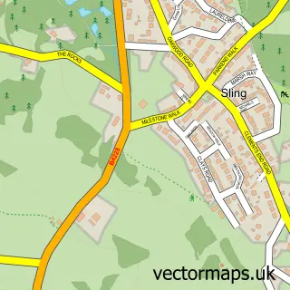
This Broadwell street map is a detailed vector street map covering a 750m x 750m area. Select a larger area to create and download your own vector street map of Broadwell.
The 750-metre map sample for Broadwell covers 336 mapped buildings and approximately 32.2 km of road detail, of which 22 named roads are named. The immediate area includes 1 GP surgery within 2 miles and 7 MOT stations within 2 miles. The wider area around Broadwell features 4 tourism points of interest, 1 hotel and 1 campsite within 2 miles. To create a larger or custom map of Broadwell, the map builder lets you define your own coverage area and download editable SVG, PDF and PNG files.
Create a larger editable map of Broadwell
Choose any area you need and generate a high-quality vector map instantly. Perfect for print, planning, design, business and personal use.

This Broadwell street map in Gloucestershire is available as downloadable SVG, PDF and PNG map files, or as a printed map for planning, business, display, education, local information and design work. You can also create a larger custom map area using the map selector.
What this Broadwell map sample shows
Broadwell lies within Coleford Cp parish, part of Berry Hill ward in the Forest Of Dean District local authority area. The postcode geography for this area includes the GL postcode area, the GL16 postcode district and the GL16 7 postcode sector. Residents fall under the Nhs Gloucestershire Integrated Care Board for NHS services.
Local features near Broadwell
Within 2 milesAmenities and services in and around Broadwell.
Administrative and postcode information for Broadwell
Broadwell lies within Coleford Cp parish, part of Berry Hill ward in the Forest Of Dean District local authority area. The postcode geography for this area includes the GL postcode area, the GL16 postcode district and the GL16 7 postcode sector. Residents fall under the Nhs Gloucestershire Integrated Care Board for NHS services.
Nearby street map samples around Broadwell

More street maps in Gloucestershire
750 metre map area coverage
Boundary, postcode and point of interest information for the 750m x 750m rectangle centred on this sample map.
Boundaries containing map centre
Constituency: Forest of Dean Co Const
County: Gloucestershire County
District: Forest of Dean District
Icb: NHS Gloucestershire ICB
Parish: Coleford CP
Police Force: gloucestershire
Postcode District: GL16
Postcode Sector: GL16 7
Ward: Berry Hill Ward
Nearby boundaries intersecting sample
Parish: West Dean CP
Ward: Bream Ward, Coleford Ward
Postcode coverage
POI category counts
Anglican Church: 2
Building Supply Store: 2
Landmark And Historical Building: 2
Professional Services: 2
Auto Electrical Repair: 1
Automotive Services And Repair: 1
Beauty Salon: 1
Bed And Breakfast: 1
Campground: 1
Charity Organization: 1
Sample points of interest
- The Church Of The Good Shepherd
- The Good Shepherd
- J.W. Lee Electrical Services
- I Fix IT Solutions
- Distinct Beauty Salon & Education
- The White House
- Coleford Electrical Services
- M D Electrical Services
- The Field Camping
- The Salvation Army
- Ernest Heal & Sons
- Heal Ernest & Sons
Create a larger editable map of Broadwell
This sample shows only a 750 metre area. To create a larger map of Broadwell, use our map builder to choose your own coverage area, add titles and download editable SVG, PDF and PNG files.
Create a custom map of Broadwell