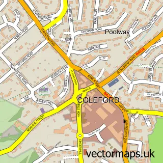
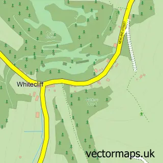
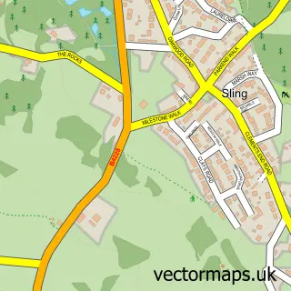
This Coalway street map is a detailed vector street map covering a 750m x 750m area. Select a larger area to create and download your own vector street map of Coalway.
The 750-metre map sample for Coalway covers 406 mapped buildings and approximately 36.1 km of road detail, of which 26 named roads are named. The immediate area includes 1 school, 1 GP surgery within 2 miles and 7 MOT stations within 2 miles. The wider area around Coalway features 1 tourism point of interest, 1 food and drink venue and 1 campsite within 2 miles. To create a larger or custom map of Coalway, the map builder lets you define your own coverage area and download editable SVG, PDF and PNG files.
Create a larger editable map of Coalway
Choose any area you need and generate a high-quality vector map instantly. Perfect for print, planning, design, business and personal use.

This Coalway street map in Gloucestershire is available as downloadable SVG, PDF and PNG map files, or as a printed map for planning, business, display, education, local information and design work. You can also create a larger custom map area using the map selector.
What this Coalway map sample shows
Coalway lies within Coleford Cp parish, part of Berry Hill ward in the Forest Of Dean District local authority area. The postcode geography for this area includes the GL postcode area, the GL16 postcode district and the GL16 7 postcode sector. Residents fall under the Nhs Gloucestershire Integrated Care Board for NHS services.
Local features near Coalway
Within 2 milesAmenities and services in and around Coalway.
Administrative and postcode information for Coalway
The local authority covering Coalway is Forest Of Dean District, within the county of Gloucestershire. The settlement lies within Berry Hill ward and Coleford Cp civil parish. The GL16 postcode district and GL16 7 postcode sector serve the immediate area. NHS provision in the area is delivered through Gloucestershire Hospitals Nhs Foundation Trust.
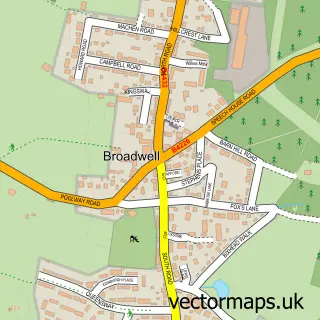
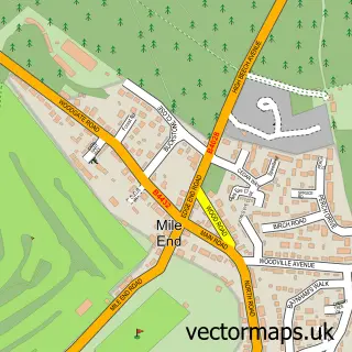
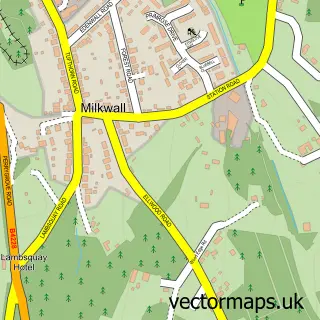
Nearby street map samples around Coalway

More street maps in Gloucestershire
750 metre map area coverage
Boundary, postcode and point of interest information for the 750m x 750m rectangle centred on this sample map.
Boundaries containing map centre
Constituency: Forest of Dean Co Const
County: Gloucestershire County
District: Forest of Dean District
Icb: NHS Gloucestershire ICB
Parish: Coleford CP
Police Force: gloucestershire
Postcode District: GL16
Postcode Sector: GL16 7
Ward: Coleford Ward
Nearby boundaries intersecting sample
Parish: West Dean CP
Ward: Berry Hill Ward, Bream Ward
Postcode coverage
POI category counts
Convenience Store: 2
Bed And Breakfast: 1
Building Supply Store: 1
Cafe: 1
Contractor: 1
Elementary School: 1
Funeral Services And Cemeteries: 1
Hair Salon: 1
Home Service: 1
Hvac Services: 1
Sample points of interest
- The White House
- Coleford Electrical Services
- Colliery Cafe
- Ernest Heal & Sons
- Premier
- SPAR
- Coalway Junior School
- Heal Ernest & Sons
- Zochi Hairdressing
- Coalway Kids Club
- Speedy Heat
- Broadwell, Forest of Dean
Create a larger editable map of Coalway
This sample shows only a 750 metre area. To create a larger map of Coalway, use our map builder to choose your own coverage area, add titles and download editable SVG, PDF and PNG files.
Create a custom map of Coalway