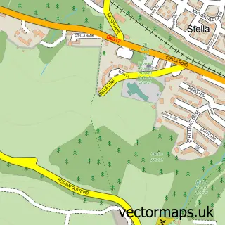
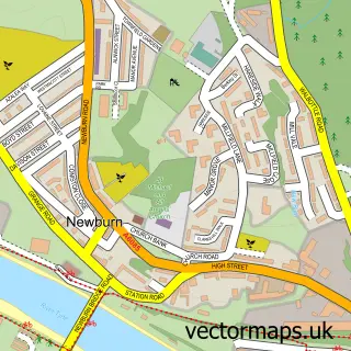
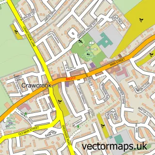
This Blaydon on Tyne street map is a detailed vector street map covering a 750m x 750m area. Select a larger area to create and download your own vector street map of Blaydon on Tyne.
The 750-metre map sample for Blaydon on Tyne covers 180 mapped buildings and approximately 23.8 km of road detail, of which 36 named roads are named. The immediate area includes 1 school, 1 railway station, 1 GP surgery, with 7 within 2 miles and 3 pubs among other local services. The wider area around Blaydon on Tyne features 2 tourism points of interest and 10 food and drink venues. To create a larger or custom map of Blaydon on Tyne, the map builder lets you define your own coverage area and download editable SVG, PDF and PNG files.
Create a larger editable map of Blaydon on Tyne
Choose any area you need and generate a high-quality vector map instantly. Perfect for print, planning, design, business and personal use.

This Blaydon on Tyne street map in Tyne & Wear is available as downloadable SVG, PDF and PNG map files, or as a printed map for planning, business, display, education, local information and design work. You can also create a larger custom map area using the map selector.
What this Blaydon on Tyne map sample shows
Blaydon on Tyne lies within Gateshead District (B) parish, part of Blaydon ward in the Gateshead District (B) local authority area. The postcode geography for this area includes the NE postcode area, the NE21 postcode district and the NE21 5 postcode sector. Residents fall under the Nhs North East And North Cumbria Integrated Care Board for NHS services.
Local features near Blaydon on Tyne
Within 2 milesAmenities and services in and around Blaydon on Tyne.
Administrative and postcode information for Blaydon on Tyne
Blaydon on Tyne lies within Gateshead District (B) parish, part of Blaydon ward in the Gateshead District (B) local authority area. The postcode geography for this area includes the NE postcode area, the NE21 postcode district and the NE21 5 postcode sector. Residents fall under the Nhs North East And North Cumbria Integrated Care Board for NHS services.
Nearby street map samples around Blaydon on Tyne

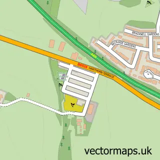
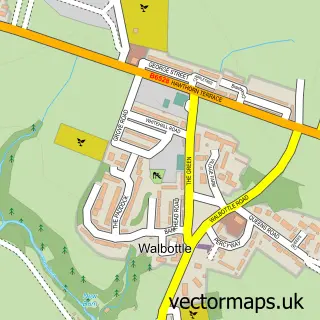
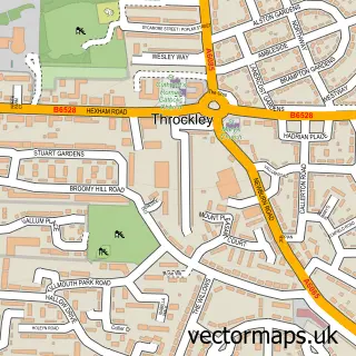
More street maps in Tyne & Wear
750 metre map area coverage
Boundary, postcode and point of interest information for the 750m x 750m rectangle centred on this sample map.
Boundaries containing map centre
Constituency: Blaydon and Consett Co Const
District: Gateshead District (B)
Icb: NHS North East and North Cumbria ICB
Police Force: northumberland
Postcode District: NE21
Postcode Sector: NE21 5
Ward: Blaydon Ward
Nearby boundaries intersecting sample
Constituency: Newcastle upon Tyne Central and West Boro Const
District: Newcastle upon Tyne District (B)
Postcode District: NE15
Postcode Sector: NE15 8, NE21 4
Ward: Lemington Ward
Postcode coverage
POI category counts
Discount Store: 7
Beauty Salon: 5
Coffee Shop: 5
Barber: 3
Church Cathedral: 3
Dentist: 3
Hair Salon: 3
Music Production: 3
Package Locker: 3
Pub: 3
Sample points of interest
- Flynns Garden
- Accounting for Good CIC
- Tyne Valley Accountants
- Moiety Design
- Sleeky Web Design & Print Ltd
- St Cuthbert
- Natural Stockcare UK
- Barnardo's
- Cashpoint® 3 Wesley Court
- Shell Blaydon (061)
- Evans Halshaw Vauxhall Blaydon
- Bells Of Blaydon
Create a larger editable map of Blaydon on Tyne
This sample shows only a 750 metre area. To create a larger map of Blaydon on Tyne, use our map builder to choose your own coverage area, add titles and download editable SVG, PDF and PNG files.
Create a custom map of Blaydon on Tyne