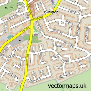
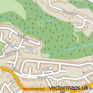
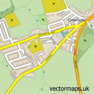
This Winlaton Mill street map is a detailed vector street map covering a 750m x 750m area. Select a larger area to create and download your own vector street map of Winlaton Mill.
The 750-metre map sample for Winlaton Mill covers 123 mapped buildings and approximately 10.2 km of road detail, of which 10 named roads are named. The immediate area includes 4 GP surgeries within 2 miles and 12 MOT stations within 2 miles. The wider area around Winlaton Mill features 1 tourism point of interest and 1 food and drink venue. To create a larger or custom map of Winlaton Mill, the map builder lets you define your own coverage area and download editable SVG, PDF and PNG files.
Create a larger editable map of Winlaton Mill
Choose any area you need and generate a high-quality vector map instantly. Perfect for print, planning, design, business and personal use.

This Winlaton Mill street map in Tyne & Wear is available as downloadable SVG, PDF and PNG map files, or as a printed map for planning, business, display, education, local information and design work. You can also create a larger custom map area using the map selector.
What this Winlaton Mill map sample shows
Winlaton Mill lies within Gateshead District (B) parish, part of Blaydon ward in the Gateshead District (B) local authority area. The postcode geography for this area includes the NE postcode area, the NE21 postcode district and the NE21 5 postcode sector. Residents fall under the Nhs North East And North Cumbria Integrated Care Board for NHS services.
Local features near Winlaton Mill
Within 2 milesAmenities and services in and around Winlaton Mill.
Administrative and postcode information for Winlaton Mill
The local authority covering Winlaton Mill is Gateshead District (B), within the county of Tyne & Wear. The settlement lies within Blaydon ward and Gateshead District (B) civil parish. The NE21 postcode district and NE21 5 postcode sector serve the immediate area. NHS provision in the area is delivered through Gateshead Health Nhs Foundation Trust.
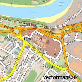
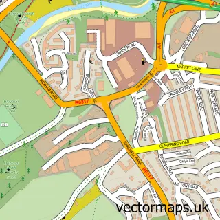
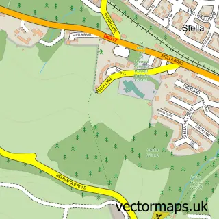
Nearby street map samples around Winlaton Mill

More street maps in Tyne & Wear
750 metre map area coverage
Boundary, postcode and point of interest information for the 750m x 750m rectangle centred on this sample map.
Boundaries containing map centre
Constituency: Blaydon and Consett Co Const
District: Gateshead District (B)
Icb: NHS North East and North Cumbria ICB
Police Force: northumberland
Postcode District: NE21
Postcode Sector: NE21 6
Ward: Winlaton and High Spen Ward
Nearby boundaries intersecting sample
Postcode District: NE16
Postcode Sector: NE16 5
Postcode coverage
POI category counts
Arts And Entertainment: 2
Beauty Salon: 2
Gas Station: 2
Automotive Repair: 1
Bar: 1
Community Center: 1
Convenience Store: 1
Flowers And Gifts Shop: 1
Food Delivery Service: 1
Furniture Store: 1
Sample points of interest
- Ann Summers Party Organiser
- Sparkle and Twist Face Painting
- DW Motorworks
- The Lounge
- Lauren's Hair Extensions
- Salon M
- Winlaton Mill Village Hall
- Winlaton Mill Convenience Store
- Flowers from the Mill
- Evri ParcelShop
- Vaintempest
- Esso Station
Create a larger editable map of Winlaton Mill
This sample shows only a 750 metre area. To create a larger map of Winlaton Mill, use our map builder to choose your own coverage area, add titles and download editable SVG, PDF and PNG files.
Create a custom map of Winlaton Mill