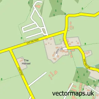
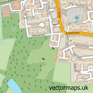
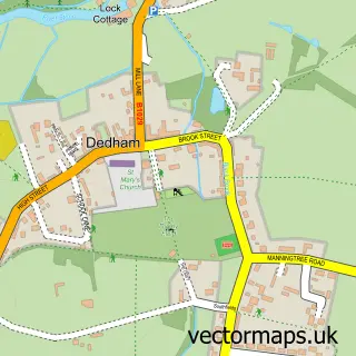
This Cattawade street map is a detailed vector street map covering a 750m x 750m area. Select a larger area to create and download your own vector street map of Cattawade.
The 750-metre map sample for Cattawade covers 193 mapped buildings and approximately 11.6 km of road detail, of which 12 named roads are named. The immediate area includes 3 GP surgeries within 2 miles, 2 pubs and 1 MOT station, with 4 within 2 miles. The wider area around Cattawade features 1 tourism point of interest and 2 food and drink venues. To create a larger or custom map of Cattawade, the map builder lets you define your own coverage area and download editable SVG, PDF and PNG files.
Create a larger editable map of Cattawade
Choose any area you need and generate a high-quality vector map instantly. Perfect for print, planning, design, business and personal use.

This Cattawade street map in Suffolk is available as downloadable SVG, PDF and PNG map files, or as a printed map for planning, business, display, education, local information and design work. You can also create a larger custom map area using the map selector.
What this Cattawade map sample shows
Cattawade lies within Brantham Cp parish, part of Brantham ward in the Babergh District local authority area. The postcode geography for this area includes the CO postcode area, the CO11 postcode district and the CO11 1 postcode sector. Residents fall under the Nhs Suffolk And North East Essex Integrated Care Board for NHS services.
Local features near Cattawade
Within 2 milesAmenities and services in and around Cattawade.
Administrative and postcode information for Cattawade
Cattawade lies within Brantham Cp parish, part of Brantham ward in the Babergh District local authority area. The postcode geography for this area includes the CO postcode area, the CO11 postcode district and the CO11 1 postcode sector. Residents fall under the Nhs Suffolk And North East Essex Integrated Care Board for NHS services.
Nearby street map samples around Cattawade

More street maps in Suffolk
750 metre map area coverage
Boundary, postcode and point of interest information for the 750m x 750m rectangle centred on this sample map.
Boundaries containing map centre
Constituency: South Suffolk Co Const
County: Suffolk County
District: Babergh District
Icb: NHS Essex ICB
Parish: Brantham CP
Police Force: suffolk
Postcode District: CO11
Postcode Sector: CO11 1
Ward: Brantham Ward
Nearby boundaries intersecting sample
No additional intersecting boundaries found.
Postcode coverage
POI category counts
Building Supply Store: 2
Pub: 2
Veterinarian: 2
Amateur Sports Team: 1
Bar: 1
Beauty Salon: 1
Building Contractor: 1
Bus Station: 1
Business Management Services: 1
Distribution Services: 1
Sample points of interest
- Brantham Athletic Football Club
- Cattawade Crown
- Karla's Beauty Box
- CBS Cleaning Services
- Decksafe Solutions
- Stour Valley Plumbing & Heating
- Panther Travel
- Step On Safety Ltd.
- AOC (UK) Ltd.
- Brantham Athletic Football Club
- GW Cleaning Services
- TJ Creations
Create a larger editable map of Cattawade
This sample shows only a 750 metre area. To create a larger map of Cattawade, use our map builder to choose your own coverage area, add titles and download editable SVG, PDF and PNG files.
Create a custom map of Cattawade