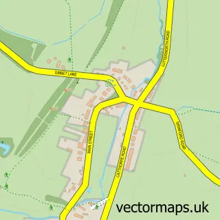
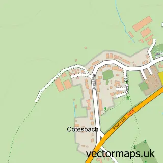
This Catthorpe street map is a detailed vector street map covering a 750m x 750m area. Select a larger area to create and download your own vector street map of Catthorpe.
The 750-metre map sample for Catthorpe covers 59 mapped buildings and approximately 13.2 km of road detail, of which 6 named roads are named. The immediate area includes 2 pubs and 1 MOT station within 2 miles. The wider area around Catthorpe features 3 tourism points of interest and 2 food and drink venues. To create a larger or custom map of Catthorpe, the map builder lets you define your own coverage area and download editable SVG, PDF and PNG files.
Create a larger editable map of Catthorpe
Choose any area you need and generate a high-quality vector map instantly. Perfect for print, planning, design, business and personal use.

This Catthorpe street map in Leicestershire is available as downloadable SVG, PDF and PNG map files, or as a printed map for planning, business, display, education, local information and design work. You can also create a larger custom map area using the map selector.
What this Catthorpe map sample shows
Catthorpe lies within Catthorpe Cp parish, part of Misterton ward in the Harborough District local authority area. The postcode geography for this area includes the LE postcode area, the LE17 postcode district and the LE17 6 postcode sector. Residents fall under the Nhs Leicester, Leicestershire And Rutland Integrated Care Board for NHS services.
Local features near Catthorpe
Within 2 milesAmenities and services in and around Catthorpe.
Administrative and postcode information for Catthorpe
The local authority covering Catthorpe is Harborough District, within the county of Leicestershire. The settlement lies within Misterton ward and Catthorpe Cp civil parish. The LE17 postcode district and LE17 6 postcode sector serve the immediate area. NHS provision in the area is delivered through University Hospitals Of Leicester Nhs Trust.
Nearby street map samples around Catthorpe

More street maps in Leicestershire
750 metre map area coverage
Boundary, postcode and point of interest information for the 750m x 750m rectangle centred on this sample map.
Boundaries containing map centre
Constituency: South Leicestershire Co Const
County: Leicestershire County
District: Harborough District
Icb: NHS Leicester Leicestershire and Rutland ICB
Parish: Catthorpe CP
Police Force: leicestershire
Postcode District: LE17
Postcode Sector: LE17 6
Ward: Misterton Ward
Nearby boundaries intersecting sample
Constituency: Daventry Co Const
District: West Northamptonshire
Icb: NHS Northamptonshire ICB
Parish: Lilbourne CP
Police Force: northamptonshire
Postcode District: CV23
Postcode Sector: CV23 0
Ward: Braunston & Crick Ward
Postcode coverage
POI category counts
Campground: 2
Pub: 2
Anglican Church: 1
Farmers Market: 1
Flowers And Gifts Shop: 1
Home And Garden: 1
Landmark And Historical Building: 1
Sample points of interest
- St Thomas', Catthorpe
- Camping at Manor Farm, Catthorpe
- Caravanning And Camping at Manor Farm
- Manor Farm Shop
- Pink Peony
- Catthorpe Loft
- Theddingworth
- Cherry Tree
- The Cherry Tree
Create a larger editable map of Catthorpe
This sample shows only a 750 metre area. To create a larger map of Catthorpe, use our map builder to choose your own coverage area, add titles and download editable SVG, PDF and PNG files.
Create a custom map of Catthorpe