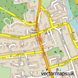
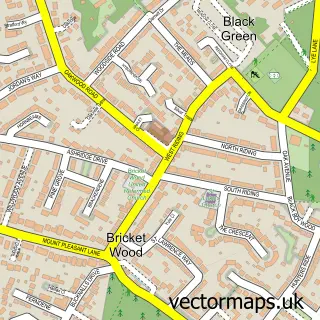
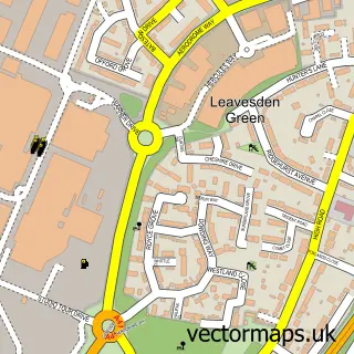
This Chiswell Green street map is a detailed vector street map covering a 750m x 750m area. Select a larger area to create and download your own vector street map of Chiswell Green.
The 750-metre map sample for Chiswell Green covers 330 mapped buildings and approximately 16.3 km of road detail, of which 26 named roads are named. The immediate area includes 4 GP surgeries within 2 miles, 2 pubs and 7 MOT stations within 2 miles. The wider area around Chiswell Green features 2 tourism points of interest and 3 food and drink venues. To create a larger or custom map of Chiswell Green, the map builder lets you define your own coverage area and download editable SVG, PDF and PNG files.
Create a larger editable map of Chiswell Green
Choose any area you need and generate a high-quality vector map instantly. Perfect for print, planning, design, business and personal use.

This Chiswell Green street map in Hertfordshire is available as downloadable SVG, PDF and PNG map files, or as a printed map for planning, business, display, education, local information and design work. You can also create a larger custom map area using the map selector.
What this Chiswell Green map sample shows
Chiswell Green lies within St. Stephen Cp parish, part of St Stephen ward in the St. Albans District (B) local authority area. The postcode geography for this area includes the AL postcode area, the AL2 postcode district and the AL2 3 postcode sector. Residents fall under the Nhs Hertfordshire And West Essex Integrated Care Board for NHS services.
Local features near Chiswell Green
Within 2 milesAmenities and services in and around Chiswell Green.
Administrative and postcode information for Chiswell Green
Chiswell Green lies within St. Stephen Cp parish, part of St Stephen ward in the St. Albans District (B) local authority area. The postcode geography for this area includes the AL postcode area, the AL2 postcode district and the AL2 3 postcode sector. Residents fall under the Nhs Hertfordshire And West Essex Integrated Care Board for NHS services.
Nearby street map samples around Chiswell Green

More street maps in Hertfordshire
750 metre map area coverage
Boundary, postcode and point of interest information for the 750m x 750m rectangle centred on this sample map.
Boundaries containing map centre
Constituency: St. Albans Co Const
County: Hertfordshire County
District: St. Albans District (B)
Icb: NHS Central East ICB
Parish: St. Stephen CP
Police Force: hertfordshire
Postcode District: AL2
Postcode Sector: AL2 3
Ward: St. Stephen Ward
Nearby boundaries intersecting sample
Postcode Sector: AL2 2
Ward: Park Street Ward
Postcode coverage
POI category counts
Convenience Store: 4
Business Consulting: 3
Nail Salon: 3
Bridal Shop: 2
Dentist: 2
Driving School: 2
Education: 2
Indian Restaurant: 2
Pub: 2
Rental Kiosks: 2
Sample points of interest
- Magenta 7
- Greenwood Cottage
- PayPoint
- Sam's Auto mobile mechanic
- Simmons Bakers
- UK Facial Aesthetics at Chiswell Green
- Beauty and Beyond
- Catrin Morris Jones Harpist
- Picture-It Video Productions
- M M Property Maintenance Ltd.
- Cnc Engineering Europe
- Retail Insight
Create a larger editable map of Chiswell Green
This sample shows only a 750 metre area. To create a larger map of Chiswell Green, use our map builder to choose your own coverage area, add titles and download editable SVG, PDF and PNG files.
Create a custom map of Chiswell Green