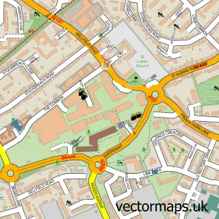
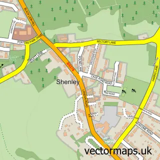
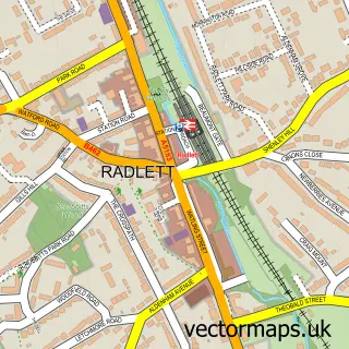
This London Colney street map is a detailed vector street map covering a 750m x 750m area. Select a larger area to create and download your own vector street map of London Colney.
The 750-metre map sample for London Colney covers 445 mapped buildings and approximately 19.4 km of road detail, of which 35 named roads are named. The immediate area includes 2 schools, 1 GP surgery, with 2 within 2 miles, 3 pubs and 3 MOT stations, with 15 within 2 miles. The wider area around London Colney features 2 tourism points of interest and 7 food and drink venues. To create a larger or custom map of London Colney, the map builder lets you define your own coverage area and download editable SVG, PDF and PNG files.
Create a larger editable map of London Colney
Choose any area you need and generate a high-quality vector map instantly. Perfect for print, planning, design, business and personal use.

This London Colney street map in Hertfordshire is available as downloadable SVG, PDF and PNG map files, or as a printed map for planning, business, display, education, local information and design work. You can also create a larger custom map area using the map selector.
What this London Colney map sample shows
London Colney lies within London Colney Cp parish, part of London Colney ward in the St. Albans District (B) local authority area. The postcode geography for this area includes the AL postcode area, the AL2 postcode district and the AL2 1 postcode sector. Residents fall under the Nhs Hertfordshire And West Essex Integrated Care Board for NHS services.
Local features near London Colney
Within 2 milesAmenities and services in and around London Colney.
Administrative and postcode information for London Colney
London Colney lies within London Colney Cp parish, part of London Colney ward in the St. Albans District (B) local authority area. The postcode geography for this area includes the AL postcode area, the AL2 postcode district and the AL2 1 postcode sector. Residents fall under the Nhs Hertfordshire And West Essex Integrated Care Board for NHS services.
Nearby street map samples around London Colney

More street maps in Hertfordshire
750 metre map area coverage
Boundary, postcode and point of interest information for the 750m x 750m rectangle centred on this sample map.
Boundaries containing map centre
Constituency: St. Albans Co Const
County: Hertfordshire County
District: St. Albans District (B)
Icb: NHS Central East ICB
Parish: London Colney CP
Police Force: hertfordshire
Postcode District: AL2
Postcode Sector: AL2 1
Ward: London Colney Ward
Nearby boundaries intersecting sample
No additional intersecting boundaries found.
Postcode coverage
POI category counts
Real Estate Agent: 6
Beauty Salon: 5
Retail: 5
Automotive Repair: 4
Building Supply Store: 4
Funeral Services And Cemeteries: 4
Motorcycle Dealer: 4
Advertising Agency: 3
Bakery: 3
Contractor: 3
Sample points of interest
- Fisher NG Chartered Accountants
- Newman Morris
- Kumon Maths & English
- Amber Mountain Marketing
- Johnson Dellow
- Sharpe Communications
- Atlas Medical Services
- The Cooperative Food (BF) London Colney (ERF), London Colney
- Morris Playing Fields
- Charlie's Auto Services
- Golden Lion Garage
- Harts Motors Markyate
Create a larger editable map of London Colney
This sample shows only a 750 metre area. To create a larger map of London Colney, use our map builder to choose your own coverage area, add titles and download editable SVG, PDF and PNG files.
Create a custom map of London Colney